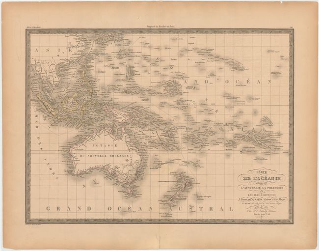
"Carte de l'Oceanie Contenant l'Australie, la Polynesie et les Iles Asiatiques", Lapie/Tardieu
Subject: South Pacific Ocean
Period: 1854 (dated)
Publication:
Color: Hand Color
Size:
21.6 x 15.7 inches
54.9 x 39.9 cm
This finely engraved chart covers the islands of the South Pacific from Southeast Asia through Hawaii, and from Australia through the Bass Islands. The map is intensely detailed, showing names of islands and island groups, harbors, channels and straits. This interesting map was published by Colonel Pierre Lapie (1777-1850) and his son Alexandre Emile, who was the Royal Geographer to the King in Paris. The map was first published in 1820, and here has been updated with the addition of Sydney on the coast. Engraved by Pierre Tardieu.
References: cf. Tooley (Australia) #851.
Condition: B+
Original outline color with light toning and a short centerfold separation that has been archivally repaired.