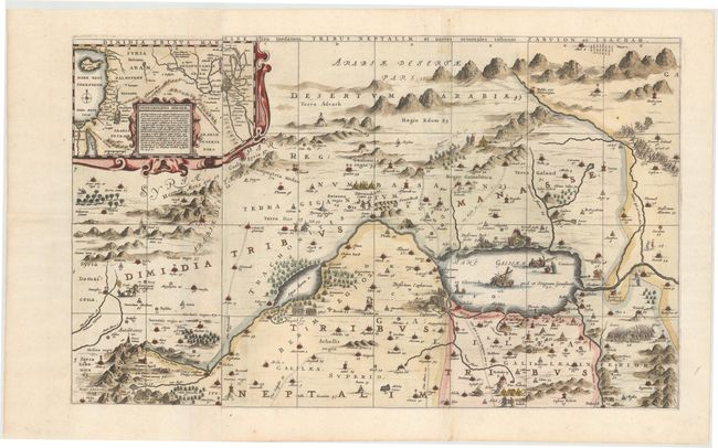
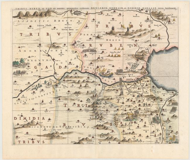
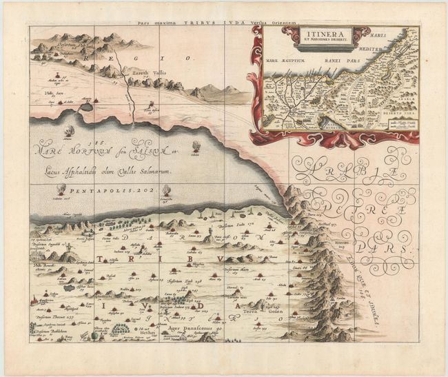
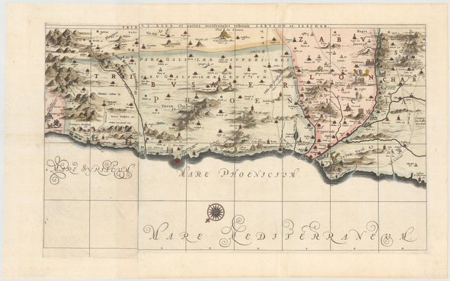
Impressive Wall Map of the Holy Land on 6 Separate Sheets
"[On 6 sheets] Dimida Tribus Manasse ... [and] Tribus Ruben, et Gad ... [and] Pars Maxima Tribus Iuda ... [and] Tribuum Ephraim ... [and] Tribus Aser ... [and] Tribus Simeon …", Jansson, Jan
Subject: Holy Land
Period: 1677 (published)
Publication: Accuratissima Orbis Antiqui Delineatio…
Color: Hand Color
Size:
28.1 x 16.9 inches
71.4 x 42.9 cm
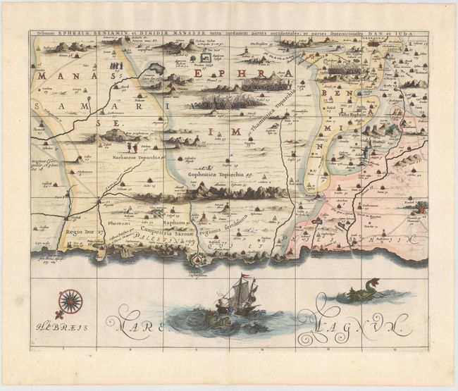
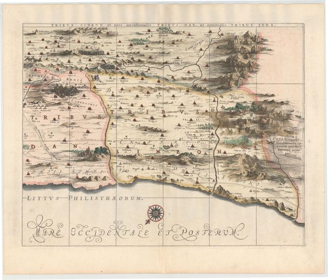
This superb, large wall map on six separate sheets is based on Adrichom's "Situs Terrae Promissionis." Oriented to the east, the map shows the region divided into the twelve tribes on both sides of the Jordan River, the shoreline running from Sidon to Alexandria. The Cison Torrens (Kishon River) is shown as connecting the Sea of Galilee with the Mediterranean Sea, and there are many nonexistent rivers, e.g., a river connecting Jerusalem with the Dead Sea. In the Dead Sea, four burning cities are shown: Sodoma, Gomorra, Seboim, and Adama. The dramatic map is beautifully engraved to show topographical features, major roads, towns and villages and richly embellished with dozens of biblical illustrations. Inset maps in the top corners depict Abraham's journey and the wandering of the Israelites through the desert. This map was published in Jansson's Accuratissima Orbis Antiqui Delineatio…, with text by Georg Horn. Two of the six sheets are made up of one and a half sheets joined together, resulting in the map sometimes being described as a seven-sheet map. The two left-hand sheets measure 28.1 x 16.9", and the remaining four sheets measure 21.3 x 17.1". If the sheets were joined the entire map would measure 70 x 34".
References: Laor #343-349.
Condition: A
Fine impressions with attractive color, wide margins, and a couple of insignificant spots.