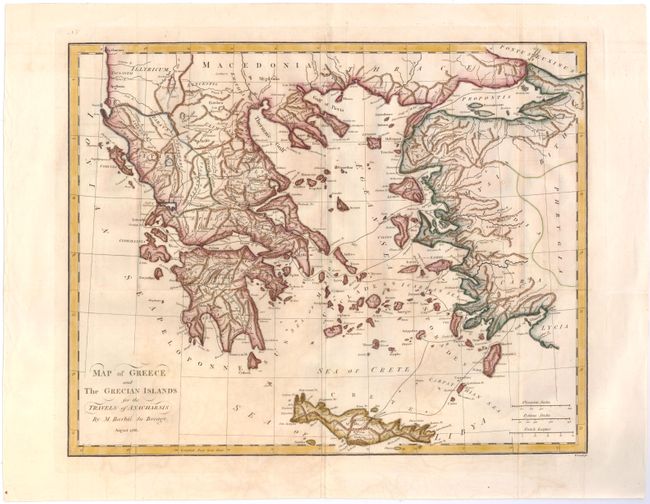
"Map of Greece and the Grecian Islands for the Travels of Anacharsis", Barbie du Bocage, Jean Denis
Subject: Greece
Period: 1788 (dated)
Publication: Travels of Anacharsis the Younger in Greece
Color: Hand Color
Size:
16.8 x 13.4 inches
42.7 x 34 cm
This detailed map of Greece, the islands of the Aegean Sea, and the adjacent coastline of Turkey illustrates the imaginary travels of Anacharsis the Younger in Greece. Crete is shown at the bottom of the map. The map is based on the cartography of D'Anville, whose work Bocage cataloged in the Bibliotheque Nationale. Engraved by T. Cook. This map was published in the English edition of Jean Jacques Barthelemy's Recueil de Cartes Geographiques Plans, Vues et Medailles de l'Ancienne Grece, Relatifs au Voyage du Jeune Anacharsis, first published in French in 1788.
References: Shirley (BL Atlases) G.BART-2a #1.
Condition: B+
Issued folding, now pressed, with light toning and offsetting, and a small abrasion in top left corner.