"[Lot of 4] Bataille de Bergen, pres Francfort… [and] Plan de la Bataille de Jaegerndorf, Entre l'Armee Prussienne... [and] Plan de la Bataille, gagne par l'Armee des Allies… [and] Plan de l’Action de Reichenberg…", Hondt, Pierre de
Subject: Germany, Czech Republic
Period: 1758-59 (dated)
Publication:
Color:
Pierre de Hondt was a prominent 18th century Dutch bookseller and publisher in the Hague, known for the high standard of typography of his books, with atlases forming a limited proportion of his output. During the Seven Years War, he diversified into map publishing, issuing a number of battle plans, most of which were engraved by Jan van Schley. His plans are very uncommon.
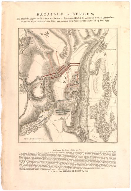
A. Bataille de Bergen, pres Francfort…, dated 1759, hand color (9.3 x 10.7"). This plan of the Battle of Bergen illustrates the action that resulted in the French army withstanding an allied British, Hanoverian, Hessian, Brunswick army attack in and around the village of Bergen near Frankfurt-am-Main. The finely engraved map shows the troop positions and the text below describes this important battle.
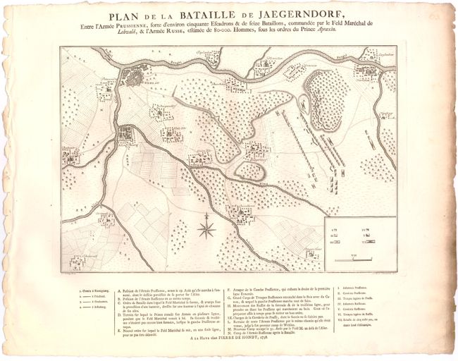
B. Plan de la Bataille de Jaegerndorf, Entre l'Armee Prussienne…, dated 1758, black & white (16 x 11"). This plan illustrates the battle of Gross-Jaegersdorf, which was a victory for the advancing Russian army. The key beneath the map explains the troop positions for the opposing Russian and Prussian armies during this battle.
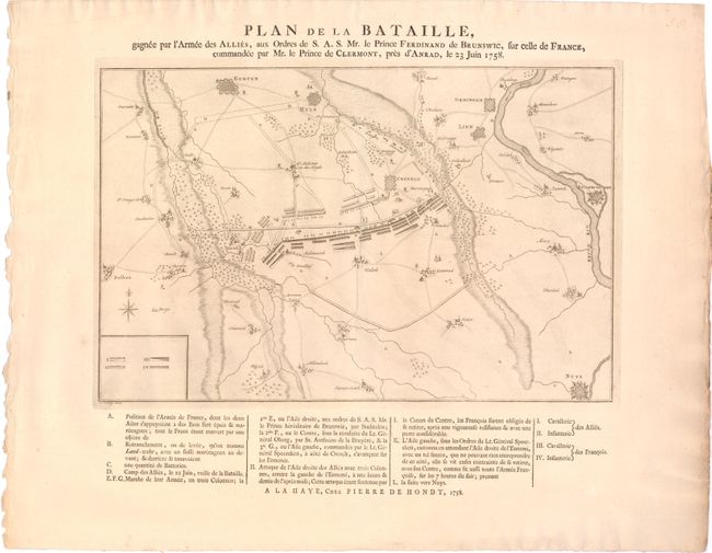
C. Plan de la Bataille, gagne par l'Armee des Allies…, dated 1758, black & white (15.8 x 10.3"). A fine plan of the battle of Krefeld between the Prussian-Hanoverian army and a French army. The plan shows the superior forces of the French army facing the defending army just outside the city of Krefeld. Prince Ferdinand outflanked the French forcing a retreat and preventing the French from aiding their Austrian allies. The plan provides extensive notations below the plan.
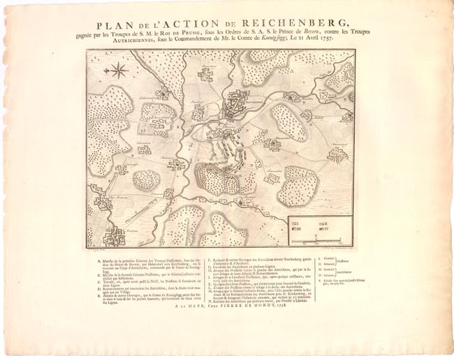
D. Plan de l’Action de Reichenberg…, dated 1758, black & white (12.5 x 9.3"). This uncommon plan illustrates the battle of Reichenberg in which Marshal von Bevern, leading the Prussian army, defeated the Austrians and captured large quantities of supplies enabling him to continue his march on to Prague. The key below explains the troop positions.
References:
Condition: A
Watermarked paper with light soil and rough paper edges, well away from the maps.