"[Lot of 2] Polar-Karte [and] Sud-Polar-Karte", Perthes, Justus
Subject: Polar
Period: 1877 (dated)
Publication: Stieler's Hand-Atlas
Color:
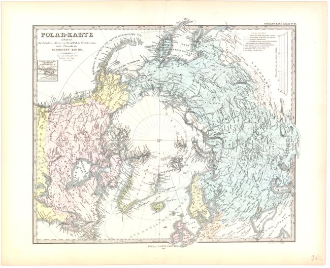
A. Polar-Karte, hand color (15.2 x 13"). Details the polar explorations and discoveries in the North Pole to date. Small inset of Beechey Island.
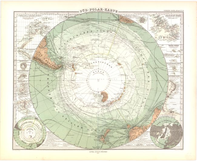
B. Sud-Polar-Karte, printed color (16.2 x 13.2"). A lovely sheet with wonderful detail and early printed coloring in the seas. Absolutely filled with information from the latest polar discoveries, current and historical explorations, ice pack location by month, sea routes and more. Surrounded by numerous insets of islands and coastal detail within the Antarctic region. Two small polar hemispheres at the lower corners.
References:
Condition: A
Light toning along sheet edges and a couple of minute worm holes only visible when held to light.