Catalog Archive
Auction 145, Lot 500

"Nouvelle Carte du Comte de Flandre", La Feuille, Daniel de

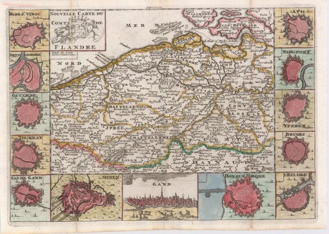
Subject: Western Belgium

Period: 1706 (circa)

Publication: Les Tablettes Guerrieres…

Color: Hand Color

Size:
10.2 x 7.1 inches
25.9 x 18 cm
Download High Resolution Image
(or just click on image to launch the Zoom viewer)

A charming small map of the historic region of Flanders, extending to Dunkerque in the west, Dendermonde in the east, and Lille and Tournai in the south. The map is surrounded by miniature bird's-eye plans of key cities, as well as a prospect view of Gent (Gand). The dates and locations of several battle sites are marked.

References:

Condition: A

Issued folding, now pressed with a hint of toning along folds.

Estimate: $140 - $170

Sold for: $150

Closed on 6/12/2013

Archived