Catalog Archive
Auction 145, Lot 451

"The Road from Prestaine in Com. Radnor to Carmarthen", Ogilby, John
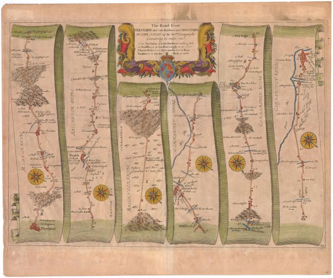
Subject: Wales

Period: 1675 (circa)

Publication: Britannia

Color: Hand Color

Size:
17.2 x 12.2 inches
43.7 x 31 cm
Download High Resolution Image
(or just click on image to launch the Zoom viewer)

John Ogilby's 'Britannia' was published between 1675 and 1698. It is a landmark in the mapping of England and Wales. Its unique format constituted the first national road-atlas of any country in Western Europe. It was composed of maps of seventy-three major roads and cross-roads, presented in a continuous strip-form, on a uniform scale of one inch to a mile. Each beautiful map includes wonderful detail of the countryside with each strip containing a large compass rose to indicate changes in direction.

This attractive strip-style map covers the road from Presteigne to Carmarthen, through Llandovery and Radnor. It is in the pictorial style pioneered by Ogilby with the road laid out in several ribbon-like panels. The road detailed is 61 miles long. Each of the seven panels has a decorative compass rose to orient the traveler. The strapwork title cartouche features the royal coat of arms.

References: Moorland & Bannister, pp. 157-8; Shirley (BL Atlases) T.OGIL-4a #84.

Condition: C+

Heavily toned with light offsetting and soiling.

Estimate: $80 - $100

Sold for: $60

Closed on 6/12/2013

Archived