"Peru", Montanus, Arnoldus
Subject: Peru
Period: 1671 (published)
Publication: De Nieuwe en Onbekende Weereld
Color: Hand Color
Size:
13.9 x 11.4 inches
35.3 x 29 cm
Montanus' work was perhaps the greatest illustrated book on the New World produced in the seventeenth century. It contained over one hundred beautifully engraved plates, views, and maps of North and South America. The plates vividly depict forts, festivals, occupations, Dutch fleets, battles, religious rites, and customs of the native inhabitants. This important work was translated into German by Olivier Dapper, and into English by John Ogilby. Several of the plates were later acquired by Pierre Vander Aa.
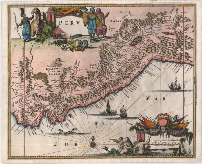
This attractive map covers Peru with parts of Ecuador and northern Chile. Dense with place names and topographical detail, it provides a marvelous view of the region. The map is oriented with north to the left although the compass rose incorrectly depicts north at top. The decorative title cartouche features natives and exotic fauna (llama, armadillo, snake and a strange lizard) and the distance scale is ornamented with merfolk and military banners and flags. Galleons and a sea monster complete the lavish composition.
References:
Condition: B+
A dark impression on watermarked paper with some printer's ink residue and a few light spots. Narrow top and bottom margins, as issued.