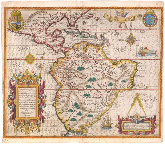
"Americae Pars Magis Cognita", Bry, Theodore de
Subject: South America
Period: 1592 (dated)
Publication: Grand Voyages
Color: Hand Color
Size:
17.4 x 14.3 inches
44.2 x 36.3 cm
Focusing on the Spanish possessions in the Americas, this map covers what is the present-day southern United States through South America. It was published to accompany the accounts of the voyages of Johann van Stadden and Jean de Lery. The cartography is drawn from de Bry's own map of Florida and the West Indies after Jacques le Moyne. However, there is no easily discernible source for the South American cartography, with its southern regions shown too broad, but not quite bulging as with the Ortelius version. De Bry's extraordinary engraving skill and artful style are very evident with the large elaborate cartouches, coats of arms, two compass roses, sea monster, Spanish galleon and intricate border.
References: Burden #80; Garratt (TMC-9) #G-3.
Condition: B
Issued folding with a 3/8" hole at the fold intersection at bottom center and a few adjacent tiny tears that have all been professionally repaired. There are several printer's creases at bottom and two spots just below the equator -- in Brazil and off the coast of Peru. Two tiny worm holes in image have been professionally infilled. Trimmed close the neatline at right, apparently as issued, and trimmed to the neatline at bottom left. Remnants of hinge tape on verso.