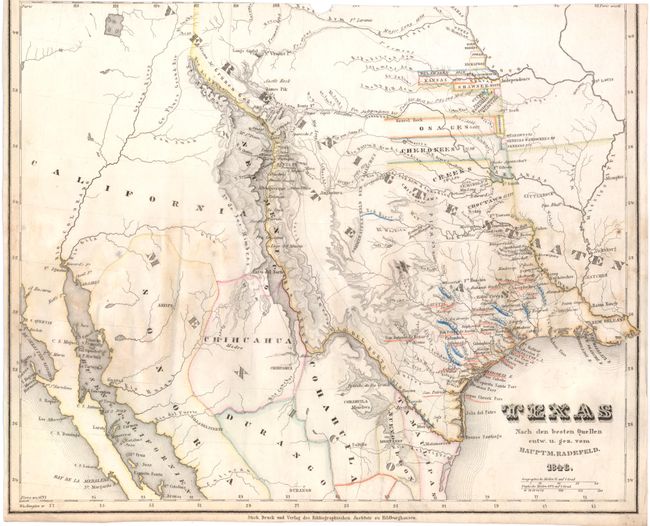
"Texas nach den Besten Quellen", Radefeld, Carl Christian Franz
Subject: Texas, Southwest U.S. & Mexico
Period: 1846 (dated)
Publication: Meyer's Grosser Hand-Atlas
Color: Hand Color
Size:
13.9 x 11.2 inches
35.3 x 28.4 cm
This scarce, early map of the new state of Texas is based upon Emory's seminal 1844 map, which was the prime source used by the U.S. Government for the annexation of Texas in December of 1845. The map extends to include much of Mexico and the Southwest, a region that was already embroiled in the Mexican-American War. It depicts the large, disputed region claimed by Texas and shows the western boundary along the Rio Grande, extending through New Mexico and Colorado to present-day Wyoming in the north. The northern boundary is undefined with several Indian Territories depicted north of the Red River. The eastern border erroneously follows the Red and Mississippi River, thus incorporating much of western Louisiana. The map provides excellent detail of forts, settlements, roads and exploration routes, including those of Long, Gregg, Pike, and Fremont.
References:
Condition: C
Original color with some soiling and minor damp stains in image. Trimmed at top, with total loss of border and a small chip in image at top center. Narrow margin at left.