"Map of the United States", Case, Tiffany & Company
Subject: United States, Mexico & Central America
Period: 1851 (dated)
Publication:
Color: Hand Color
Size:
23.5 x 24 inches
59.7 x 61 cm
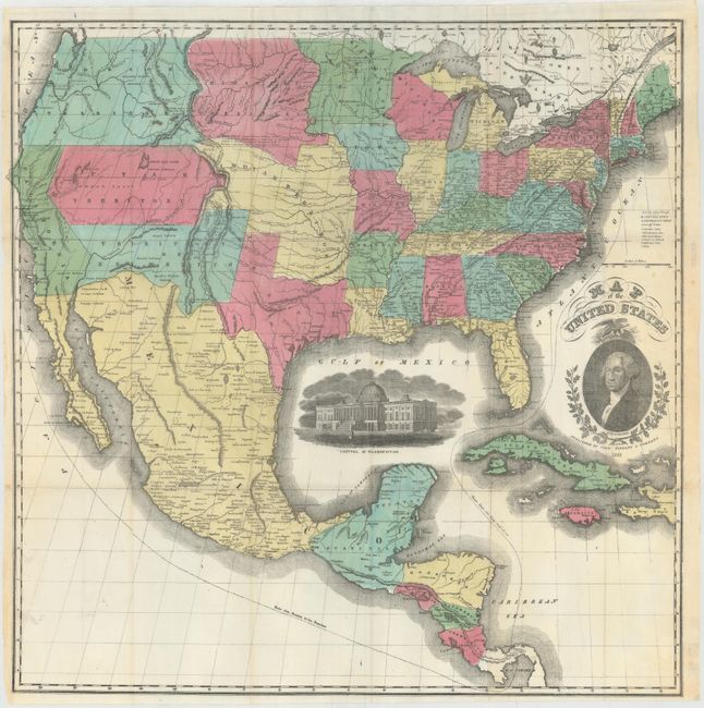
A scarce large format map of the United States with striking insets of a President Washington and a view of the Capitol of Washington. The projection oddly distorts and for-shortens the western portion of the U.S. The very interesting territorial configurations include the pre-Gadsden Purchase border with Mexico, a large Oregon Territory occupying the entire Northwest and extending to the Continental Divide. Bordering Oregon is a huge Missouri Territory that extends east to an oversized Minnesota Territory at the Missouri River. The very large Indian Territory sits between Utah, Missouri, and Missouri Territory. Utah and New Mexico are at their largest extent. In Utah is the Mormon Settlement at the Great Salt Lake. The map extends to include most of Central America and the western part of the West Indies.
References:
Condition: A
A fine example with bright, full original coloring on thin banknote style paper. Folding as issued with faint toning along the edges of the sheet.