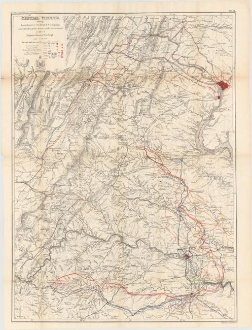
"Central Virginia Showing Lieut. Genl. U.S. Grant's Campaign and Marches of the Armies under his Command in 1864-5", U.S. Army
Subject: Virginia, Civil War
Period: 1864-5 (dated)
Publication: Report of Chief Engineer U.S.A., 39th Congress, 1st Session
Color: Printed Color
Size:
22.8 x 31.3 inches
57.9 x 79.5 cm
This large folding Civil War map is dated 1864-65 but was published in the Chief Engineer's report of 1866. The map describes the military actions in the region between Harper's Ferry in the north, Washington D.C., the James River and Petersburg in the east, and Staunton to the west. Lynchburg and Petersburg are the southern-most cities. Legend and overprinted color show the movements of the Secretary of War and the various Corps of General Grant's Army. Information includes roads, villages, railroads, watershed and the terrain in hachure. The coat-of-arms for the Army Corps of Engineers is below the title. This map is plate No. 11 from the report and is drawn on the scale of five miles per inch. It is an early published Civil War map; most reports and maps withheld publication until the 1890's to allow time for the national wound to heal sufficiently for a public discussion of the conflict.
References: Stephenson (CW) #516.
Condition: B+
Issued folding with light toning along the folds and a few short splits at fold intersections.