"[Lot of 2] Map of Oregon, Washington, and Part of British Columbia [and] Map of Kansas, Nebraska and Colorado", Mitchell, Samuel Augustus
Subject: Western United States
Period: 1860-61 (dated)
Publication:
Color: Hand Color
Size:
12.5 x 10 inches
31.8 x 25.4 cm
Size varies slightly.
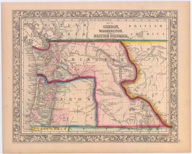
A. Map of Oregon, Washington, and Part of British Columbia, dated 1860. In 1859, Oregon became a state and in the process Washington Territory gained land from Oregon that eventually became Idaho and part of Montana. The map clearly shows the Oregon Trail, and the Emigrant Wagon Road to California. The entire eastern half of Oregon is unorganized with Klamath, Curry and Wasgoren (likely an editing error for Wasco) Counties being the furthest east. The eastern part of the state is labeled as unexplored. Klamath County was not organized until 1882, so its appearance here is a mystery, as the decorative floral border of this edition was replaced long before 1882.
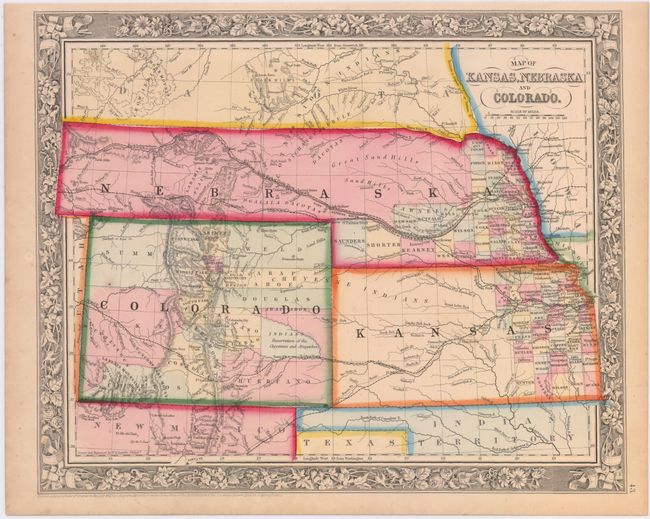
B. Map of Kansas, Nebraska and Colorado, dated 1861. This colorful map features Nebraska with a long panhandle extending all the way to present-day Idaho. Several wagon roads are depicted and the Pony Express route is named. Numerous Indian tribes, forts and trading posts are located. County development in Kansas and Nebraska is limited to mostly the eastern edge. Denver City is located on the banks of Cherry Fork with Auraria shown directly south of the city. Names the North, Middle, and South Parks. Map is enclosed in a lovely floral border.
References: Blevins, Mapping Wyoming #146.
Condition: A
Vivid color with a hint of toning and a few tiny, unobtrusive spots.