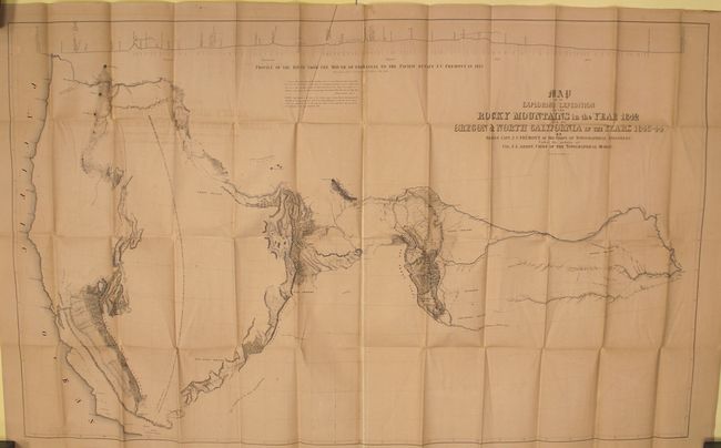
"Map of an Exploring Expedition to the Rocky Mountains in the Year 1842 and to Oregon & North California in the Years 1843-44 [with] Report of The Exploring Expedition to the Rocky Mountains…", Fremont/Preuss
Subject: Western United States
Period: 1845 (published)
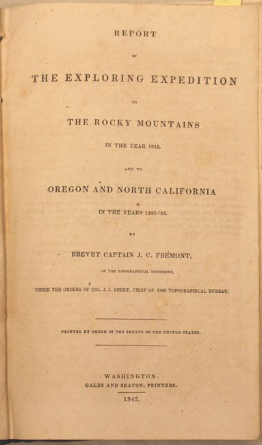
Publication: Senate Ex. Doc. 174, 28th Congress, 2nd Session
Color: Black & White
Size:
51 x 30.5 inches
129.5 x 77.5 cm
This is the large edition of the influential map which details John Charles Fremont's epic exploration of the American West. Fremont and his traveling companion and topographer, George Carl Preuss, launched the expedition from the frontier settlement of Westport at the juncture of the Kansas and Missouri Rivers. There Fremont first met Kit Carson who signed on as guide to the expedition. This is the large edition of the influential map that details John Charles Fremont's epic exploration of the American West. Fremont and his traveling companion and topographer, George Carl Preuss, launched the expedition from the frontier settlement of Westport at the juncture of the Kansas and Missouri Rivers. There Fremont first met Kit Carson who signed on as guide to the expedition. Traveling across the Rocky Mountains at South Pass to the Columbia River in Oregon Territory, they then continued south along the Sierra Nevada nearly to the "Pueblo del los Angeles", northeast to Lake Utah and finally east to the Arkansas River. Fremont's map and report had a profound influence on emigration to the Far West as his westward route eventually became the Oregon Trail. Wheat, who called this "an important step forward from the earlier western maps" devoted seven text pages to its description. The map was drawn by Charles Preuss "whose skill in sketching topography...has probably never been surpassed in this country." There is much to study and appreciate in this rare map, but we return to Wheat for this short praise: "To Fremont and his magnificence map of his Second Expedition all praise. This is an altogether memorable document in the cartographic history of the West, and for it alone Fremont would deserve to be remembered in history."
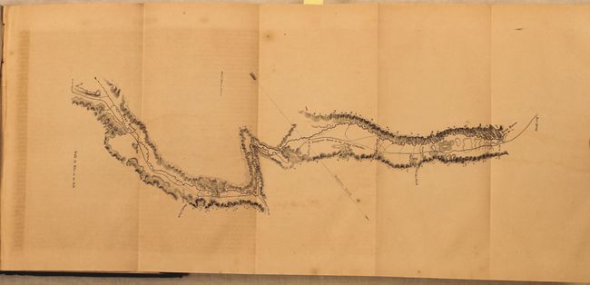
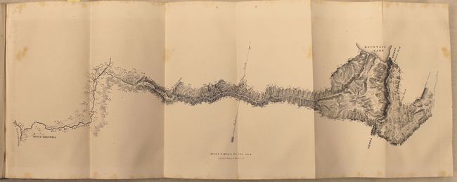
Included is an untitled folding map (23 x 9") showing their route between Mountain Lake (Lake Tahoe) in the Sierra's and Nueva Helvetica. Fremont's party enjoyed a two-week respite as the guest of John Sutter near the famous Sutter's Mill. Also contains the single page map of The Great Salt - Lake which is an early map of the area including the front of the Wasatch Mountains.
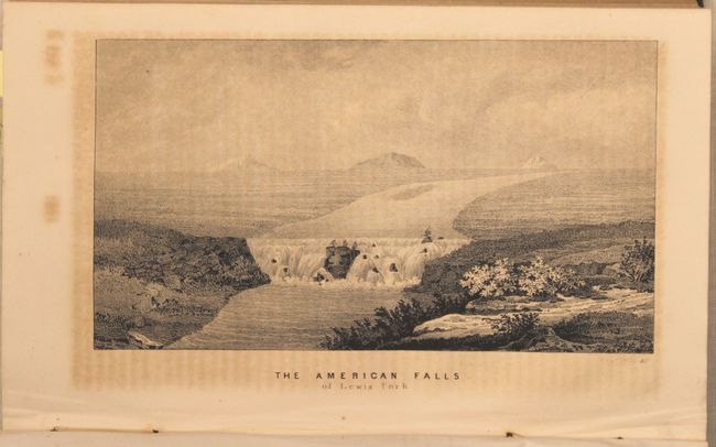
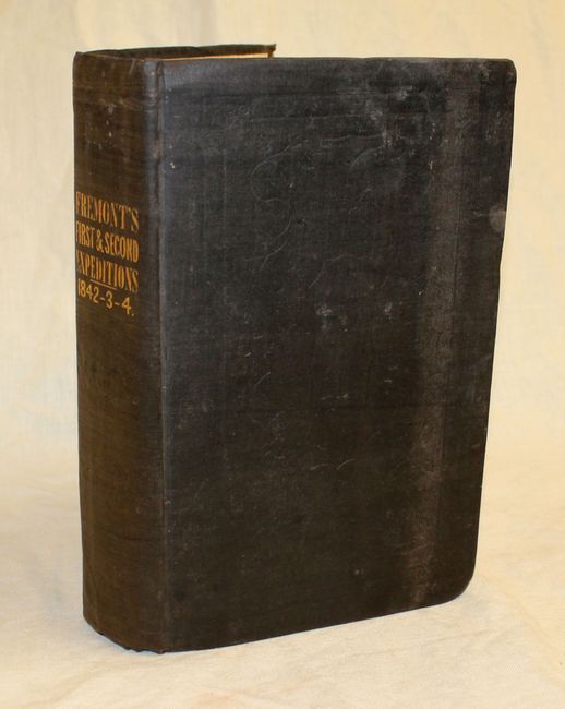
This is the Senate issue. Octavo, hardbound in brown cloth boards, 693 pp., 22 plates and 5 maps. The body of the book contains Fremont's two reports, titled "A Report on an Exploration of the Country Lying Between the Missouri River and the Rocky Mountains" and "A Report of the Exploring Expedition to Oregon and North California, in the Years 1843-'44."
References: Wheat (TMW) #497; Wagner-Camp #115.1.
Condition: B+
Issued folding with light offsetting and numerous short splits at fold intersections closed on verso with archival tape. Text and plates have the typical scattered foxing and toning. Contents are tight with covers and spine showing light wear.