"The Historical War Map", Asher & Company
Subject: Southern United States, Civil War
Period: 1862 (dated)
Publication:
Color: Printed Color
Size:
24.2 x 24.3 inches
61.5 x 61.7 cm
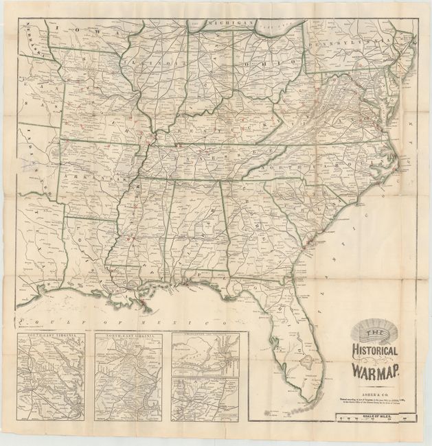
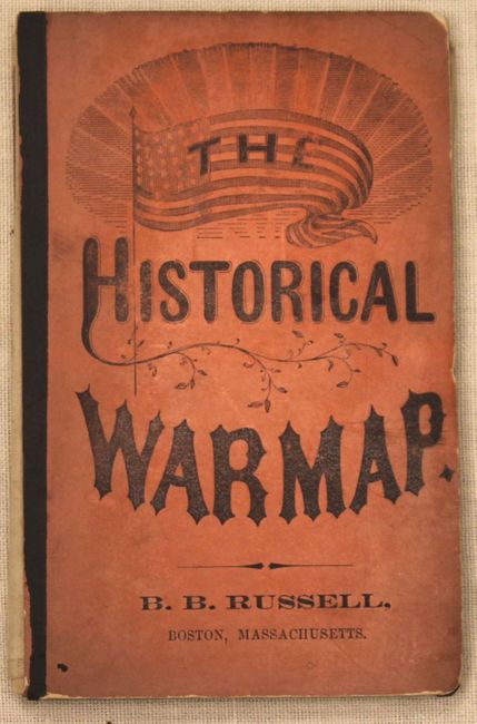
This is Asher's superb and scarce pocket map of the region involved in the Civil War. Locates the battle sites through October of 1863. The map covers the general area of the war showing towns, railroads, waterways and forts. State boundaries are colored green and battle sites are located with a red overprinted circle. Includes insets of South-East Virginia, North-East Virginia, Charleston and Vicinity, and Vicksburg and Vicinity. Folds into orange paper covers with "Rebellion Record" containing a fascinating contemporary view of the war, 72 pp. including four small battle plans.
References: Stephenson #22.
Condition: C+
Issued folding with numerous fold separations that have been mostly closed on both recto and verso with archival tape. There is 1" circular puncture in Indian Territory that has also been closed on both recto and verso with archival material. Covers are present, but the map is detached and the back cover is separated.