Catalog Archive
Auction 145, Lot 149

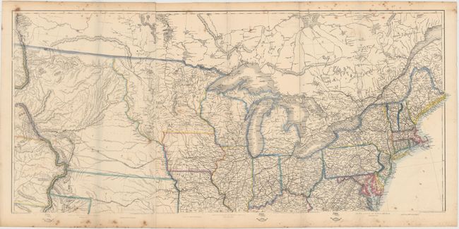
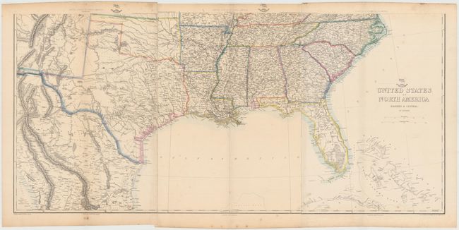
"[On 2 sheets] United States of North America (Eastern & Central)", Ettling, Theodor

Subject: United States, Civil War

Period: 1860 (circa)

Publication: Weekly Dispatch Atlas

Color: Hand Color

Size:
36 x 16.8 inches
91.4 x 42.7 cm
Download High Resolution Image
(or just click on image to launch the Zoom viewer)

This six-sheet map shows the westward growth of the emerging states and territories just before and during the Civil War. The map covers the region from the eastern seaboard to just past the Rocky Mountains. The routes of the proposed transcontinental railroad as surveyed by Capt. Gunnison, Lieut Beckwith and Gov. Stevens are described, and the tracks of Fremont, Whiting, Connelly and others are shown. The emigrant road is shown with numerous important landmarks along the route noted. Numerous forts and Indian tribes are located, and there is good detail of roads, towns rivers, and topography throughout. Issued on six sheets, now joined in two horizontal sections.

The Weekly Dispatch Atlas was published in monthly segments for subscribers of the Weekly Dispatch newspaper. The monthly editions eventually grew to include maps covering most of the known world. Published in various editions from 1855 through the early 1880s. Each map has the Dispatch Atlas seal above the title or in the margin.

References:

Condition: B+

Original outline color with very light toning and a few small spots.

Estimate: $400 - $500

Sold for: $150

Closed on 6/12/2013

Archived