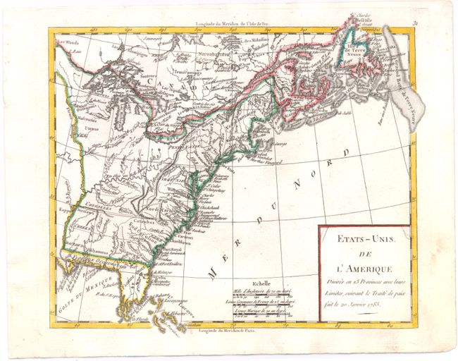
"Etats-Unis de l'Amerique Divises en 13 Provinces avec leurs Limites, suivant le Traite de Paix Fait le 20 Janvier 1783", Robert de Vaugondy
Subject: United States & Canada
Period: 1785 (circa)
Publication:
Color: Hand Color
Size:
9 x 7.4 inches
22.9 x 18.8 cm
This is an early map of the newly created United States. The map shows the eastern seaboard as far north as Newfoundland and to the Mississippi River in the west. The southern portion of Florida is fragmented into numerous waterways. Western Florida extends to the Mississippi River. The oversized Pennsylvania extends to about 43°, joining the northern shore of Lake Erie. Filled with many Indian tribes including the Mohawks in northern New York and many more. This map is a slight variation from the reference - it is from the same plate which was re-engraved to remove "Par LaMarche Geogr?" which still shows faintly behind the newly engraved horizontal line. The dating on the map refers to the Treaty of Paris ending the Revolution. Longitude west from Paris displayed at bottom, east from l'Isle de Fer at top.
References: cf. McCorkle #783.12.
Condition: A
A nice impression with marginal soiling.