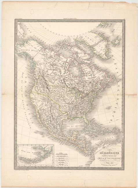
"Carte de l'Amerique Septentrionale", Lapie, Alexander Emile & Pierre
Subject: North America
Period: 1830 (dated)
Publication:
Color: Hand Color
Size:
15.8 x 22 inches
40.1 x 55.9 cm
This is an interesting 19th century map of the continent showing the United States in an evolving configuration. The boundary between the United States and Canada reflects the United States claims in the disputed Columbia region (Oregon). Alaska is Amerique Russe with Nouveau Cornouailles (New Cornwall) occupying the panhandle. Mexico still encompasses Texas and the Southwest. The map shows good detail of cities, rivers and locations of Indian tribes but does not show state or territorial boundaries. At lower left is an inset of the Aleutian Islands and Bering Sea. Engraved by Lallemand with Lapie's embossed stamp next to the distance scale.
References:
Condition: B
There is a centerfold separation that extends 1.3" into the map image and a 1" tear near the center of the map which have both been repaired on verso with archival tape. There are a few edge tears and small damp stains confined to the blank margins.