Catalog Archive
Auction 144, Lot 92

"Plan de la Baie et du Havre de Casco et des Iles Adjacentes…", Sartine

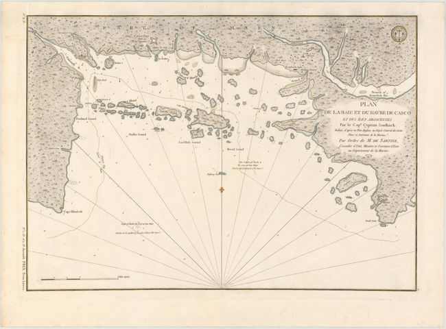
Subject: Casco Bay, Maine

Period: 1779 (dated)

Publication:

Color: Hand Color

Size:
23 x 16 inches
58.4 x 40.6 cm
Download High Resolution Image
(or just click on image to launch the Zoom viewer)

This curious chart of Casco Bay on the Maine coast was drawn by Captain Cyprian Southack and reissued by Antoine Sartine for the French Navy in 1779 during the American Revolutionary War. The map contains a number of inaccuracies, showing misshapen islands off of Portland Harbor and an inaccurate coastline from Portland to Small Point. The chart includes a dotted line course called Channel Way entering the Bay at Cape Elizabeth, weaving through the islands, and exiting at Small Point. Interestingly, the anchorages in the English edition were mistakenly interpreted by the French copyist as symbols for currents. The seal of the Depot de Marine is at top right.

References: Sellers & Van Ee #843.

Condition: A

Strong impression on thick watermarked paper with a few faint spots.

Estimate: $1,000 - $1,200

Sold for: $650

Closed on 4/3/2013

Archived