Catalog Archive
Auction 144, Lot 279

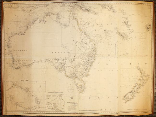
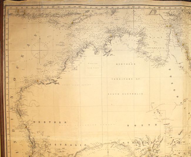
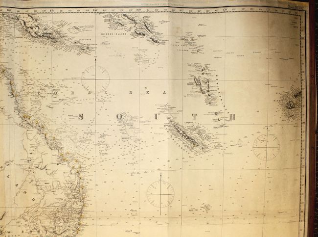
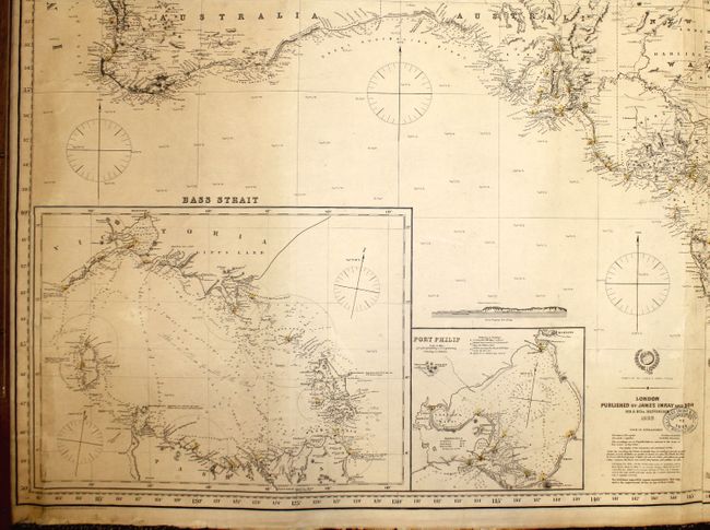
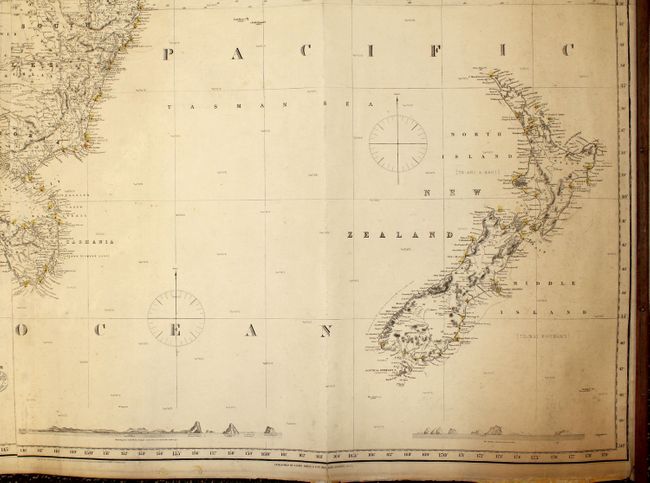
A Rare and Detailed Navigational Chart

"Australia and New Zealand", Imray, James

Subject: Australia & New Zealand

Period: 1894 (dated)

Publication:

Color: Black & White

Size:
57.8 x 42.5 inches
146.8 x 108 cm
Download High Resolution Image
(or just click on image to launch the Zoom viewer)

An impressive blue-backed chart on four joined sheets showing Australia and New Zealand, and extending to include parts of Java and New Guinea, the Solomon Islands, New Hebrides, New Caledonia and Fiji. This highly detailed chart includes both topographical and hydrographical information, including tides, currents, soundings, lighthouses (marked with red and yellow), and navigational notes. The interior of Australia is left blank, but there is good detail of rivers, topography, towns and counties along the coasts and in New South Wales and Queensland. At bottom left are two large inset charts of Bass Strait and Port Philip. The chart also includes three landfall approach views of: 1) Mount Egmont (Mount Taranaki), New Zealand, as seen from a New Plymouth anchorage; 2) Point Nepean at the entrance to Port Philip; 3) and the Snares Islands. This is one of the largest and most comprehensive charts of the South Pacific area designed for navigation in the late 19th century. The chart was published by James Imray & Sons, in London and is typical of Imray's desire for accuracy indicated by his note at the base of the chart that says: "The publisher respectively requests communications that may tend to the improvement of this or any other works." Adjacent to the publisher's imprint at bottom center is a blue stamp indicating that the chart was "Corrected to 1894." The chart is on four sheets, joined and attached to wooden rollers at both sides. On verso is a gold label stating: "Chart No. 197 Australia, New Zealand, and Ancient Islands" with a marked price of 12s.

This chart is very rare. We have not found any examples of this chart being offered for sale in the past 30 years, and have only found one other example, dated 1897 and housed in the National Library of Australia.

References:

Condition: B+

Original color (red and yellow) on lighthouses, with light toning and soiling, and a few minor pencil notations. There are a few short tears that have been closed on verso with archival tape, including one that enters 2.5" at bottom left, one that enters border at bottom right, and two that enter 1" to 2" at top left. Otherwise a very good example of such a large chart.

Estimate: $1,600 - $1,800

Sold for: $2,500

Closed on 4/3/2013

Archived