Catalog Archive
Auction 144, Lot 247

"Eastern Passages to China Sheet I", Horsburgh, James (Capt)

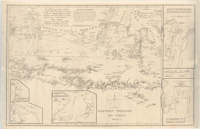
Subject: East Indies - Indonesia

Period: 1848 (dated)

Publication:

Color: Black & White

Size:
37.6 x 24.5 inches
95.5 x 62.2 cm
Download High Resolution Image
(or just click on image to launch the Zoom viewer)

Large, detailed chart covering the southern region of Borneo, the Java Sea, part of Java, Sumbawa, Flores, part of Sulawesi, and all of the smaller Indonesian islands. The chart includes numerous soundings and two possible routes to China. Four insets titled Sketch of Bally Strait, Sketch of Lombock Strait, Sketch of Sapy Strait, and Plan of Allass Strait from Observations Made by James Horsburgh in 1796 surround the map, and small views of the "straits of Salayer from the Westward" are shown as well. Text at top dedicates the chart to the "Commanders & Officers of the Honble. East India Companys Ships."

References:

Condition: B+

A few small stains.

Estimate: $550 - $700

Sold for: $700

Closed on 4/3/2013

Archived