Catalog Archive
Auction 144, Lot 19

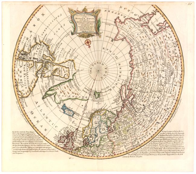
"A New & Accurate Map of the North Pole, with all the Countries Hitherto Discovered, Situated Near or Adjacent to it, as well as Some Others More Remote…", Bowen, Emanuel

Subject: North Pole

Period: 1747 (circa)

Publication: A Complete System of Geography

Color: Hand Color

Size:
16 x 15 inches
40.6 x 38.1 cm
Download High Resolution Image
(or just click on image to launch the Zoom viewer)

Handsome polar map covering the region north of 50 degrees, closely based on Moll's map from 1705. It contains numerous notations concerning recent discoveries and the entire western part of North America is labeled Parts Undiscovered. There is also a notation of a New Discover'd Sea in Hudson's Bay that is totally fictitious. At bottom are lengthy English text panels describing the possibilities of still discovering northeast and northwest passages to Asia, which "would greatly shorten the length and lessen the expenses of East India voyages; and consequently be of considerable advantage to our British trade and navigation." Further paragraphs of text provide the names of the navigators consulted in the formation of this chart and a note that "the publick is in great expectation of new discoveries from the expedition of the Dobbs Galley and the California which passed by Yarmouth the 31st of May 1746 under convoy of the Loo of 40 Guns on their voyage to discover the N.W. Passage by Hudson's Streights." Nicely decorated with a compass rose and a title cartouche surrounded by ornamental scrolls and foliage. This is the second state of this map, with the plate number "No. 70" engraved at lower left center.

References: Phillips (A) #603-70; Kershaw: #420; Shirley (BL Atlases) T.BOW-2a #70.

Condition: B+

Attractive color with a few small spots, a hint of toning along centerfold, and a printer's crease adjacent to centerfold.

Estimate: $450 - $550

Sold for: $425

Closed on 4/3/2013

Archived