Catalog Archive
Auction 144, Lot 172

"Nieuwe Pascaert Beuattende in sich de Kust van Vlaenderen van de Wielingen tot de Hoofden", Keulen, Johannes van

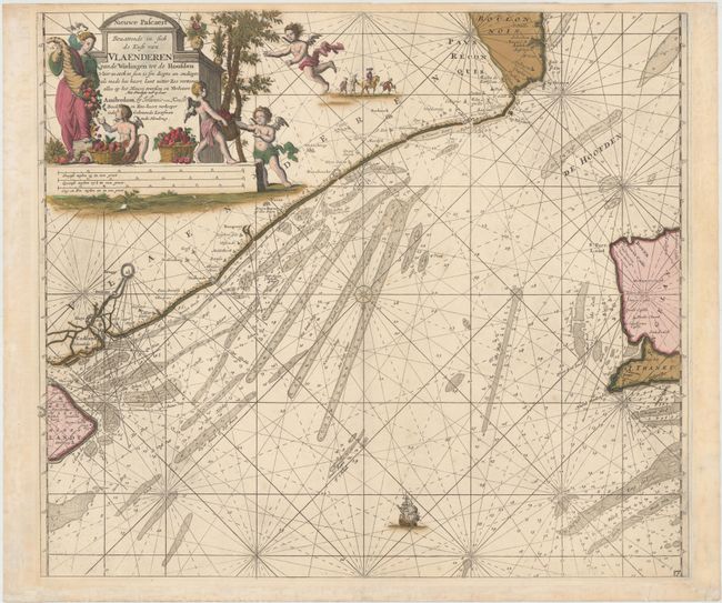
Subject: Western Belgium and Northern France

Period: 1680 (circa)

Publication: Zee-Atlas

Color: Hand Color

Size:
22.5 x 22 inches
57.2 x 55.9 cm
Download High Resolution Image
(or just click on image to launch the Zoom viewer)

This handsome sea chart shows the coast of Flanders from just south of Calais to the Westerschelde, the estuary of the Scheldt River, and extends west to include the coast of England from Dover to Margate. Numerous soundings, fishing banks, sand banks, and navigational hazards are depicted throughout. A compass rose towards the center orients north to the bottom of the chart. The chart is further ornamented by a sailing galleon and an allegorical title cartouche featuring a cornucopia and several putti with baskets of fruit.

References:

Condition: C+

Stunning original color with minor soiling and a number of cracks and a few small holes (at bottom of title cartouche) caused by the oxidation of the green pigment, all of which have been closed on verso with archival tape.

Estimate: $350 - $450

Sold for: $170

Closed on 4/3/2013

Archived