Catalog Archive
Auction 144, Lot 158

"A New Map of England & Wales, Compiled from the Actual Surveys of the Counties, and Regulated by the Latest Astronomical Observations; with the Turnpike Roads...", Laurie, Richard Holmes

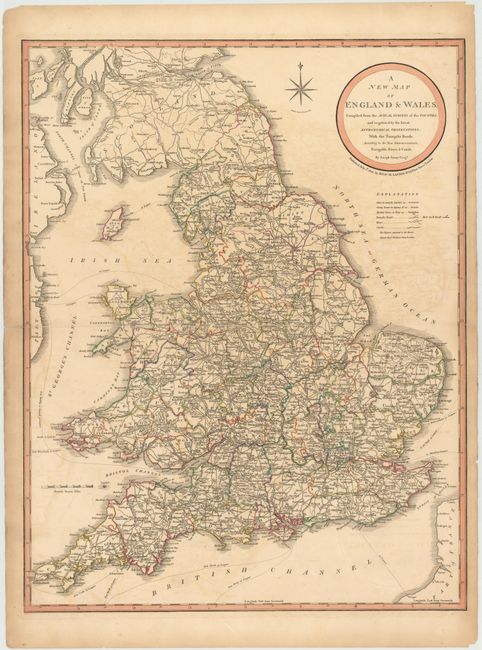
Subject: England & Wales

Period: 1820 (dated)

Publication:

Color: Hand Color

Size:
19.8 x 25.5 inches
50.3 x 64.8 cm
Download High Resolution Image
(or just click on image to launch the Zoom viewer)

This detailed map of England and Wales depicts towns, counties, turnpike roads, mail coach roads, rivers, and canals. A note below the brief legend explains that the numbers adjacent to town names indicates their distance to London. The map also includes the navigation distance in leagues between England and several locations in Ireland, France, and the Low Countries. The map is based on the work by Joseph Enouy and published by Richard Laurie.

References:

Condition: B

Original color with some offsetting and a few minute worm holes only visible when held to light. A long centerfold separation and several separations along the plate mark in blank margins have all been closed with archival tape.

Estimate: $275 - $350

Sold for: $180

Closed on 4/3/2013

Archived