Catalog Archive
Auction 144, Lot 154

"[Untitled - Approaches to Land's End with the Scilly Isles]", Collins, Capt. Greenvile

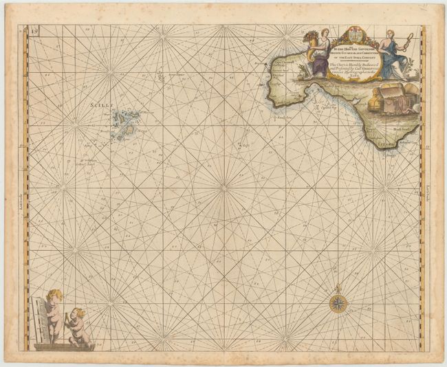
Subject: Southwestern England, Scilly Isles

Period: 1693 (circa)

Publication: Great Britain's Coasting-Pilot

Color: Hand Color

Size:
22 x 18 inches
55.9 x 45.7 cm
Download High Resolution Image
(or just click on image to launch the Zoom viewer)

This is a beautiful sea chart of Land's End and Lizard Point on Cornwall's most southerly coastal region. This chart is typical of Collins' work, with a highly decorative dedication cartouche in top right flanked by two figures, a shield, a trunk, and several bales. The cartouche contains a dedication to the Governor, Deputy Governor and Committees of the East India Company. A compass rose and distance scale with two cherubs complete the composition.

In 1681 Capt. Greenville Collins (fl.1669-1694) an officer in the Royal Navy was appointed by the Admiralty to make a complete survey of the coasts of Great Britain. Prior to this date the charts used by English mariners were copies of Dutch charts that had many inaccuracies. The task of surveying the entire coasts was formidable and took about 7 years, at the end of which only 46 surveys were finally used in an atlas titled "Great Britain's Coasting-Pilot Being a New and Exact Survey of the Sea-Coast of England," which was first published in 1693.

References: Shirley (BL Atlases) M.COLL-1 #11.

Condition: B+

Printed on heavy paper with light foxing primarily confined to blank margins and damp stains in right and left blank margins.

Estimate: $375 - $450

Sold for: $200

Closed on 4/3/2013

Archived