Catalog Archive
Auction 144, Lot 153

"Holy Island Staples and Barwick is most Humbly Dedicated and Presented to Capt. Will Davies Vice Admirall to the Rt. Honorable the Earle of Torrington", Collins, Capt. Greenvile

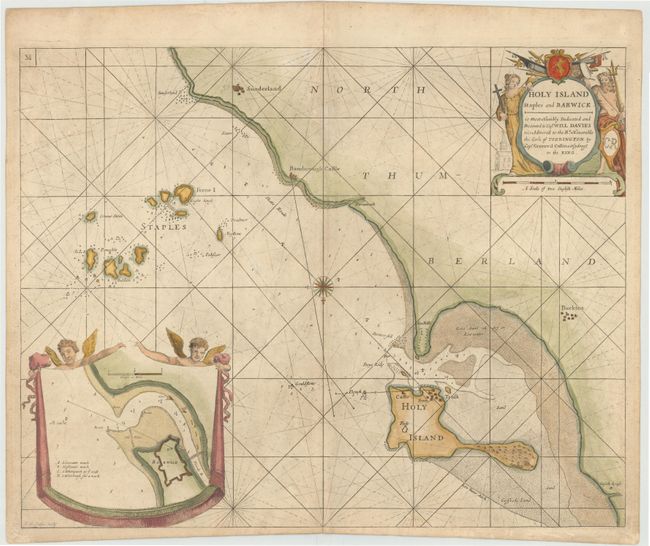
Subject: Northern England

Period: 1693 (circa)

Publication: Great Britain's Coasting-Pilot

Color: Hand Color

Size:
22 x 17 inches
55.9 x 43.2 cm
Download High Resolution Image
(or just click on image to launch the Zoom viewer)

This very handsome chart shows the coast of Northumberland with Holy Island and the Farne (Staples) Islands offshore. Only a few place names appear on the coast, including Sunderland, Bamborough Castle, and Buckton. The chart shows good navigational detail, including soundings, anchorages, shoals, and rocks. A decorative compass rose orients the chart with north at the bottom. At bottom left is an inset chart of the fortified city of Berwick (Barwick) on the Tweed River on a handsome banner held up by two angels. The decorative title cartouche features Neptune, a female figure holding a cross, a church, weaponry, and a dedication to Captain Will Davies. Engraved by F.W. Oetjes.

In 1681 Capt. Greenville Collins (fl.1669-1694) an officer in the Royal Navy was appointed by the Admiralty to make a complete survey of the coasts of Great Britain. Prior to this date the charts used by English mariners were copies of Dutch charts that had many inaccuracies. The task of surveying the entire coasts was formidable and took about 7 years, at the end of which only 46 surveys were finally used in an atlas titled "Great Britain's Coasting-Pilot Being a New and Exact Survey of the Sea-Coast of England," which was first published in 1693.

References: Shirley (BL Atlases) M.COLL-1 #38.

Condition: B+

Printed on heavy paper with light soiling.

Estimate: $400 - $475

Sold for: $300

Closed on 4/3/2013

Archived