Catalog Archive
Auction 144, Lot 132

"Paraguay, o Prov. de Rio de la Plata cum Regionibus Adiacentibus Tucuman et Sta. Cruz de la Sierra", Jansson, Jan

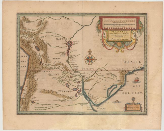
Subject: Central South America, Paraguay

Period: 1630 (circa)

Publication:

Color: Hand Color

Size:
18.9 x 14.6 inches
48 x 37.1 cm
Download High Resolution Image
(or just click on image to launch the Zoom viewer)

This fine map of the region includes the Paraguay River basin and the Peru-Chilean coast with Lake Titicaca. The Rio de la Plata is boldly shown with many large islands in the broad river. The mythical Lago de los Xarayes is featured on the map, which was believed to connect the Rio de la Plata and Amazon River systems. Several towns are named including Rio de Janeiro, Sao Paulo, Buenos Aires, Medoca, Arica, Potosi and Cuszco. The map is nearly identical to Blaeu's map of the same title with a large decorative title cartouche incorporating the distance scales, smaller cartouche with armillary sphere, a large compass rose, sea monster, and here Jansson has added a sailing ship off the coast of Brazil. French text on verso.

References:

Condition: B

A nice impression with wide margins, light toning and soiling, and show-through of text on verso. There are light damp stains at bottom center and bottom left and an archivally repaired tear that just enters map image at right above imprint. A small surface abrasion in imprint has also been archivally repaired, with a minor amount of text replaced in facsimile.

Estimate: $300 - $400

Sold for: $220

Closed on 4/3/2013

Archived