Catalog Archive
Auction 143, Lot 504

"Duche et Gouvernem-General de Normandie Divise en Haut et Bas en Divers Pays et Bailliages avec le Gouvernement General de Havre de Grace…", Seutter, Matthias

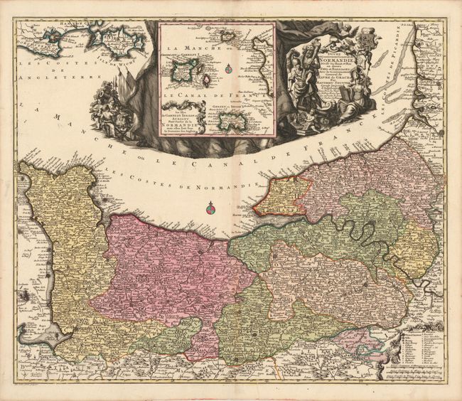
Subject: Northern France

Period: 1740 (circa)

Publication:

Color: Hand Color

Size:
23 x 19.3 inches
58.4 x 49 cm
Download High Resolution Image
(or just click on image to launch the Zoom viewer)

Finely engraved map showing all of the Normandy coast and well inland with detail of hundreds of villages and towns as well as the topography of the land. The political divisions, bailliages, are based on the manuscripts of Sanson. At top is an inset, "Les Isles de Garnezey Ierzay et Aurigny Font Partie de la Normandie mais Elles Sont Sous la Domaine des Anglois," showing the Channel Islands. The inset is surrounded by an elaborate title cartouche featuring Hercules, Minerva, a soldier and weaponry, putti, and cherubs playing musical instruments. Engraved by Tobias Conrad Lotter.

References:

Condition: B+

Original color on watermarked paper with light toning along centerfold, a short printer's crease near centerfold at bottom, and a few worm tracks at top left and right corners of the neatline.

Estimate: $150 - $180

Sold for: $110

Closed on 2/13/2013

Archived