Catalog Archive
Auction 143, Lot 401

"A Map of Chili, Patagonia, Part of La Plata &c.", Moll, Herman

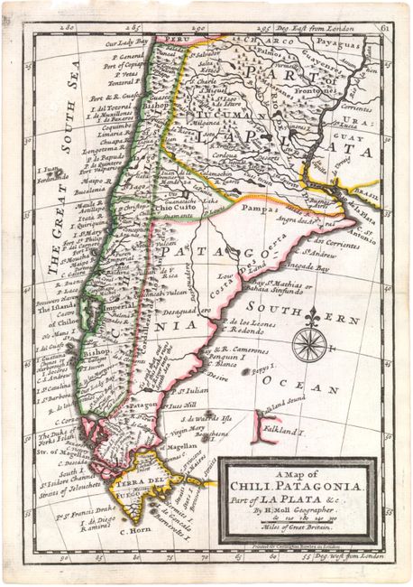
Subject: Southern South America

Period: 1740 (circa)

Publication: Atlas Geographicus

Color: Hand Color

Size:
6.9 x 10 inches
17.5 x 25.4 cm
Download High Resolution Image
(or just click on image to launch the Zoom viewer)

Detailed copper engraved map of the tip of South America with Tierra del Fuego, Le Maire Strait, and a partial outline of the Falkland Islands. Decorated with a simple block style title cartouche and a compass rose. Printed for Carrington Bowles.

References: Shirley (BL Atlases) T.MOLL-3a #87.

Condition: B+

Watermarked paper with some faint soiling.

Estimate: $160 - $200

Sold for: $200

Closed on 2/13/2013

Archived