Catalog Archive
Auction 142, Lot 625

"Caucasus & Crimea with the Northern Portions of the Black & Caspian Seas", Fullarton, Archibald & Co.

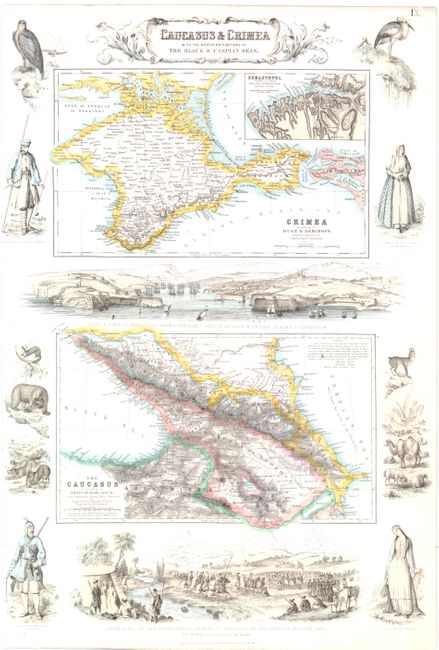
Subject: Caucasus and Crimea

Period: 1860 (circa)

Publication: The Royal Illustrated Atlas

Color: Hand Color

Size:
12.5 x 17.7 inches
31.8 x 45 cm
Download High Resolution Image
(or just click on image to launch the Zoom viewer)

This sheet contains two detailed maps of Crimea and of the Caucasus region. The map of Crimea includes an inset of the port of Sevastopol in the southern region. Elaborate vignettes of animals, regional men and women, a military scene, and a view of Sevastopol surround the maps.

References:

Condition: A

The left margin has been slightly trimmed resulting in very minor loss of one vignette.

Estimate: $150 - $180

Sold for: $110

Closed on 11/28/2012

Archived