Catalog Archive
Auction 142, Lot 525

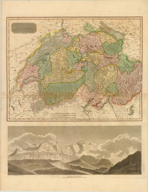
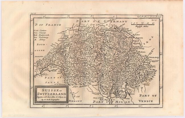
"[Lot of 2] Swisserland [on sheet with] Mont Blanc Nearly Three Miles above the Level of the Sea [and] Suisse or Switzerland Together with their Allies & Subjects &c.",

Subject: Switzerland

Period: 1745-1814 (circa)

Publication:

Color:

Size:
See Description
Download High Resolution Image
(or just click on image to launch the Zoom viewer)

A. Swisserland [on sheet with] Mont Blanc Nearly Three Miles above the Level of the Sea, by John Thomson, from New General Atlas, published 1814, hand color (19.3 x 22.5"). This is a very handsome map of Switzerland divided by cantons with dense detail of towns, roads, rivers and topographical detail. Below the map is a dramatic view of Mont Blanc. Dimensions given for map (19.3 x 15") and view (19.3 x 7") together. Condition: Original color with light offsetting, toning along centerfold, and a few minor spots in the image. (B+)

B. Suisse or Switzerland Together with their Allies & Subjects &c, by Herman Moll, from Salmon's Modern History, circa 1745, black & white (10.0 x 7.0"). This small map extends from Lake Geneva in the west to the Tyrol province of Italy in the east. The map is densely filled with mountains and lakes and identifies the "League of the House of God." A scale of English miles and a legend locating cantons, counties, bailywicks, territories and abbeys appear at the top of the map. Condition: (A)

References:

Condition:

See description above.

Estimate: $140 - $170

Unsold

Closed on 11/28/2012

Archived