Catalog Archive
Auction 142, Lot 515

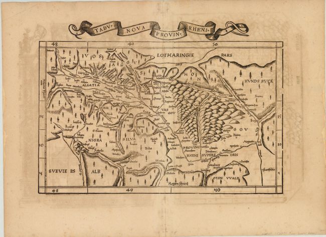
"Tabu. Nova Provin. Rheni", Ptolemy/Fries
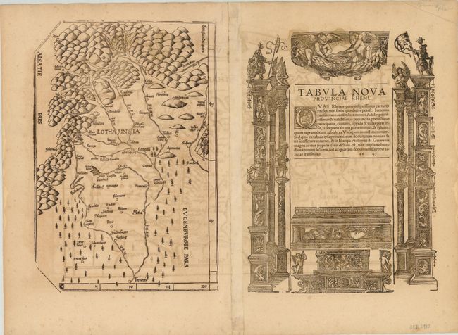
Subject: Western Germany, Rhine River

Period: 1525 (circa)

Publication: Claudii Ptolemaei Geographicae…

Color: Black & White

Size:
16.8 x 12 inches
42.7 x 30.5 cm
Download High Resolution Image
(or just click on image to launch the Zoom viewer)

This woodcut is one of the earliest "modern" maps of the Rhine River Valley and the Black Forest region. Oriented with north to the right, the map extends from Frankfurt (Frantfordia) to Basel (Basilea), naming numerous towns in between. On verso is Latin text with the full title Tabula Nova Provinciae Rheni surrounded by elaborate woodcut decorations, as well as a second map depicting the region directly to the west of the Rhine River Valley depicting the Moselle River between Thionville (Treneris), Metz (Metis), Nancy (Nancein), and beyond.

References: Mickwitz & Miekkavaara #208-46.

Condition: B

Wide, original margins with show-through of text on verso and a few small worm tracks along centerfold.

Estimate: $600 - $700

Sold for: $450

Closed on 11/28/2012

Archived