Catalog Archive
Auction 142, Lot 443

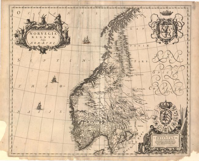
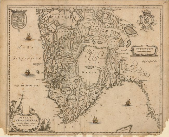
"[Lot of 2] Norvegia Regnum, vulgo Nor-Ryke [and] Dioecesis Stavangriensis, & Partes Aliquot Vicinae, Opera L. Scavenii, S.S.", Blaeu, (Family)

Subject: Norway

Period: 1680 (circa)

Publication:

Color: Black & White

Size:
19.7 x 16.3 inches
50 x 41.4 cm
Download High Resolution Image
(or just click on image to launch the Zoom viewer)

This lot includes two maps of Norway. The maps have no text on verso indicating they were issued after the demise of the great Blaeu publishing empire, as these were among the plates auctioned in 1677 following the fire that destroyed the printing house. Size varies slightly.

A. Norvegia Regnum, vulgo Nor-Ryke. This is one of the few early, separate maps of Norway, and perhaps the most decorative map of the country. It is richly decorated with elaborate cartouches and coats of arms. The cartouche at lower right includes a dedication to Prince Christian who became King Christian V of Denmark and Norway in 1670. The map depicts Norway up to Senja with the adjacent territories that had recently been acquired by Sweden through the treaties of Roskilde and Copenhagen. Detail is confined primarily to the coastlines and rivers, as there was very little known of the mountainous interior during this period. Ref: Goss (Blaeu) #6, p.34-5; Ginsberg (Scandia) #CE52. Condition: There is soiling, light scattered foxing, and a minute pinhole at top right. A tear that enters 7" into map image at top has been repaired with archival materials. Paper has been added in blank margins to repair several chips, with minute loss of neatline. Backed with Japanese tissue.

B. Dioecesis Stavangriensis, & Partes Aliquot Vicinae, Opera L. Scavenii, S.S. This fine map shows the Bishopric of Stavanger and the adjacent regions from the work of Laurids Clausen Scavenius, the bishop of Stavanger from 1605 to 1626. The map locates the major villages and towns and presents reasonable coastal detail. However, the interior topography is not very accurate with Opslo Tellemarck shown as a large empty region, save for a large lake and a notation describing the road from Stavanger to Hallengdal as "very hard due to the steepness of the mountains." The map is beautifully embellished with two coats of arms, four sailing ships and two fine cartouches. Ref: Ginsberg (Scandia) #CE51. Condition: The four ships are hand colored. There is scattered foxing and light soil within the image. The map has been backed with Japanese tissue with paper added to margins at bottom, repairing several chips with loss of image in border. A short tear in top blank margin has been closed on verso with archival tape.

References:

Condition: C+

See description.

Estimate: $1,200 - $1,500

Sold for: $600

Closed on 11/28/2012

Archived