Catalog Archive
Auction 142, Lot 411
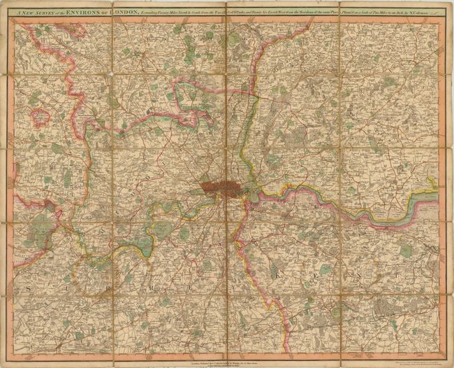
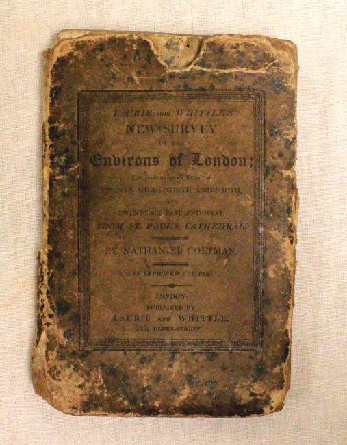
"A New Survey of the Environs of London, Extending Twenty Miles North & South from the Parallel of St. Pauls; and Twenty Six East & West from the Meridian of the Same Place...", Laurie & Whittle
1 of 2
Subject: London, England
Period: 1816 (dated)
Publication:
Color: Hand Color
Size:
26.7 x 21.5 inches
67.8 x 54.6 cm
Download High Resolution Image
(or just click on image to launch the Zoom viewer)
(or just click on image to launch the Zoom viewer)