Catalog Archive
Auction 142, Lot 403

"Novissima et Accuratissima Totius Angliae, Scotiae et Hiberniae Tabula…", Danckerts, Theodore

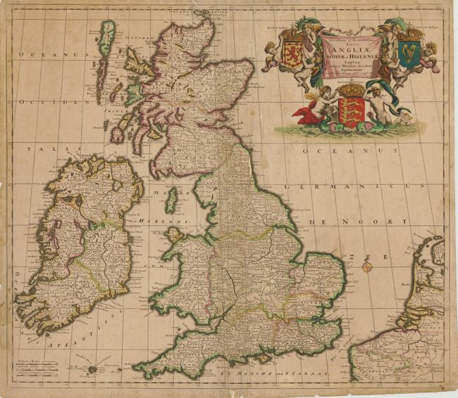
Subject: Britain & Ireland

Period: 1685 (circa)

Publication:

Color: Hand Color

Size:
22.5 x 19.8 inches
57.2 x 50.3 cm
Download High Resolution Image
(or just click on image to launch the Zoom viewer)

This rare, large decorative map of the British Isles is filled with details on provinces, towns and counties. A large drape-style title cartouche is surrounded by putti and the royal coats of arms. This is the second state of the map as it designates the English Channel "La Manche sive T Canaal."

References: Shirley (BI), Danckerts 2.2.

Condition: C+

Original color. There are several small areas of loss along the centerfold, most of which have been repaired on verso with archival material, along with extraneous creasing along the centerfold. Light scattered staining and soiling.

Estimate: $400 - $500

Sold for: $210

Closed on 11/28/2012

Archived