Catalog Archive
Auction 142, Lot 387

"Nieuwe Wassende Graade Zee Kaart over de Spaanse Zee van't Kanaal tot 't Eyland Cuba in Westindia / Nouvelle Carte Marine Reduite de la Mer. D. Espagne / The New Sea Map of the Spannish Zee", Keulen, Gerard van

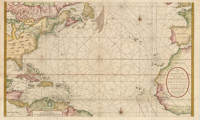
Subject: Atlantic Ocean

Period: 1710 (circa)

Publication:

Color: Hand Color

Size:
39 x 23.5 inches
99.1 x 59.7 cm
Download High Resolution Image
(or just click on image to launch the Zoom viewer)

This sea chart of the Atlantic is filled with place names along the coastlines. In the western hemisphere, the map extends from Newfoundland to the equator, including the northern coast of South America and the Caribbean Islands. In North America, the majority of the Great Lakes are shown, along with an exaggerated Long Island (Long I. ou Jork Shire), and a large lake (Apalache Lac) in South Carolina. Florida is presented in a triangular shape, with large islands forming the tip and numerous soundings along the coast. The coasts of Britain, France, Spain, and western Africa are shown in the eastern hemisphere. A large cartouche contains the title in Dutch, French and English, and four compass roses complete the composition. Engraved by I. van Anse. Printed on two sheets, joined as issued.

References:

Condition: B+

There are professional repairs to separations and several small holes along a horizontal fold towards bottom with a small amount of map in facsimile and minute loss of image. There are a few small spots and minor soiling. Overall still a very nice example of this large chart.

Estimate: $2,400 - $2,750

Sold for: $1,800

Closed on 11/28/2012

Archived