Catalog Archive
Auction 142, Lot 318

"Carte Reduite du Golphe du Mexique et des Isles de l'Amerique, Dressee au Depost des Cartes et Plans de la Marine pour le Service des Vaisseaux du Roy", Bellin, Jacques Nicolas

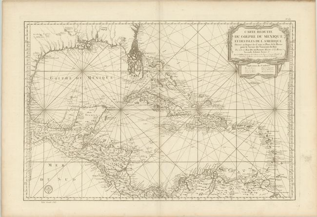
Subject: Gulf of Mexico and Caribbean

Period: 1760 (circa)

Publication:

Color: Black & White

Size:
31.7 x 21.1 inches
80.5 x 53.6 cm
Download High Resolution Image
(or just click on image to launch the Zoom viewer)

This large, impressive chart of the Gulf of Mexico and the Caribbean shows the Florida Peninsula as a maze of islands. The map was clearly meant to facilitate sailing, with loxodromic lines, the locations of safe anchorages, navigational hazards and the directions of major currents. A lovely cartouche fills the upper right, with a color key underneath to identify the possessions of the French, Spanish, English, Dutch and Danish, however this issue is uncolored. Second state, as noted in the cartouche with the last part of the date excised, and with the seal of the Depot de la Marine and the price, Prix. Trente Sols, at bottom left.

References: Tooley (MCC-96) #748.

Condition: A

Clean and bright on a sturdy sheet of wide-margined paper with large watermarks. There is an archivally repaired hole in right blank margin, not affecting map.

Estimate: $1,400 - $1,800

Unsold

Closed on 11/28/2012

Archived