Catalog Archive
Auction 142, Lot 212

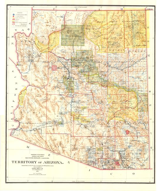
"Territory of Arizona", General Land Office

Subject: Arizona

Period: 1901 (dated)

Publication: HR Doc No. 5, 57th Cong., 1st Session

Color: Printed Color

Size:
17 x 22 inches
43.2 x 55.9 cm
Download High Resolution Image
(or just click on image to launch the Zoom viewer)

A colorful and fascinating map with great detail issued eleven years before statehood. The extent of nine Indian reservations and at least three Military reservations, including Camp Apache, are clearly shown in different colors. Numerous confirmed and unconfirmed land claims are named and located. A huge Grand Canyon Forest Reserve is shown. The brown hachured mountain area and the blue waterways combine to provide great visual impact. Information includes watershed, mountains, railroads, wagon roads, private claims, unsurveyed townships, etc. A beautiful example published while Harry King was the Chief of Drafting and the Hon. Binger Hermann was commissioner. Included with the map is the associated 142 page disbound report from the Territorial Governor of Arizona, Nathan Oakes Murphy, that includes 27 photographic plates and 1 small folding map.

References:

Condition: A

Issued folding with a binding trim at left. Report text and plates are clean and bright but should be considered a collection of loose sheets.

Estimate: $200 - $250

Sold for: $100

Closed on 11/28/2012

Archived