Catalog Archive
Auction 142, Lot 207

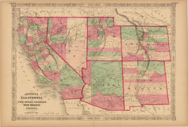
"Johnson's California, also Utah, Nevada, Colorado, New Mexico, and Arizona", Johnson, A. J.
Subject: Southwestern United States

Period: 1864 (dated)

Publication: New Illustrated Family Atlas

Color: Hand Color

Size:
23.3 x 16.5 inches
59.2 x 41.9 cm
Download High Resolution Image
(or just click on image to launch the Zoom viewer)

This is a later edition from the previous lot (#206) which shows the original four counties of Yavapai, Mohave, Yuma and Pima in the newly organized Arizona Territory, with Prescott as the capital. The Utah/Nevada border is now at 114° and Arizona has its final borders. Nevada has its name in an early configuration engraved in a vertical arc. Early historical details include the Pony Express & United States Mail Route, the emigrant roads to California, and the proposed southern railroad route. Historical and statistical information on the verso.

References:

Condition: B+

Original color with light toning primarily along the edges of the sheet, else very good.

Estimate: $180 - $220

Sold for: $90

Closed on 11/28/2012

Archived