Catalog Archive
Auction 142, Lot 203

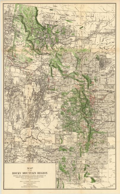
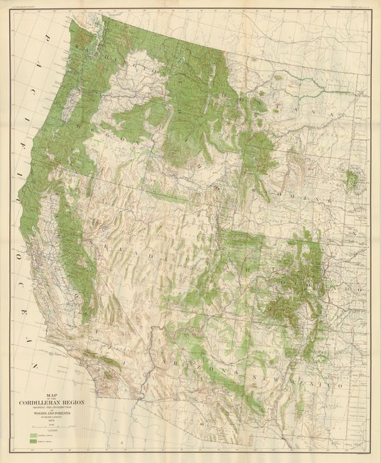
"[Lot of 2] Map of the Rocky Mountain Region Showing the Approximate Location and Extent of Forest Areas and Irrigation Ditches in 1885 [and] Map of the Cordilleran Region Showing the Distribution of Woods and Forests",

Subject: Western United States

Period: 1885-98 (dated)

Publication:

Color: Printed Color

Size:
See Description
Download High Resolution Image
(or just click on image to launch the Zoom viewer)

A. Map of the Rocky Mountain Region Showing the Approximate Location and Extent of Forest Areas and Irrigation Ditches in 1885, by A. Hoen & Co., dated 1885, (19.2 x 31.5"). Uncommon map of the Intermountain West featuring forest lands shown in green and main irrigation canals shown with red overprinting. Stretches from Canada to Mexico and includes Idaho, Montana, Wyoming, Utah, Colorado and New Mexico with most of Arizona. Remarkable detail throughout including surveyed townships, towns, forts, Indian reservations, watershed, and topography by hachure. An important map documenting the canal and irrigation systems eventually created in the West. Finely lithographed by the firm of A. Hoen of Baltimore..

B. Map of the Cordilleran Region Showing the Distribution of Woods and Forests, by Henry Gannett, dated 1898, (29.8 x 36.3"). This is a colorful and detailed map of the entire western United States covering the region from New Mexico to California north to Montana and Washington. Cordillera refers to a system of mountains, and in this case features the Rocky Mountains, Sierra Nevada and Cascade ranges. The map is shaded in light and dark green representing wooded and forest areas. There is also extensive detail of relief, rivers and county boundaries.

References:

Condition: A

Both issued folding with a hint of toning along a few folds.

Estimate: $150 - $200

Sold for: $75

Closed on 11/28/2012

Archived