Catalog Archive
Auction 142, Lot 178

"A New and Accurate Map of the Chief Parts of South Carolina, and Georgia, from the Best Authorities", Lodge, John

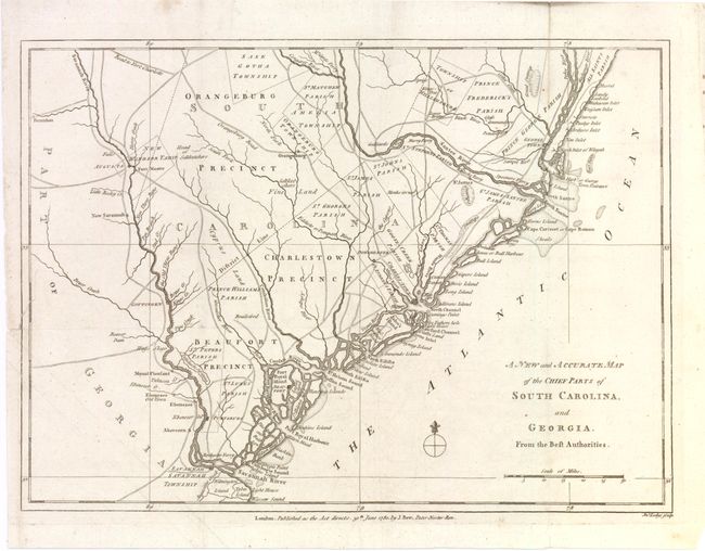
Subject: Colonial Southeast, Charleston

Period: 1780 (dated)

Publication: Political Magazine

Color: Black & White

Size:
15 x 10.8 inches
38.1 x 27.4 cm
Download High Resolution Image
(or just click on image to launch the Zoom viewer)

Scarce Revolutionary War map of the region in South Carolina and Georgia from about the Savannah River to the Wackamaw River. The map was created to depict important battle sites and British victories during the Southern Theater of the war, including the capture of Savannah, Georgia in December 1778 and Charleston, South Carolina in May 1780. The map is filled with detailed information of the roads, forts, towns, townships, precincts and parishes. Published by John Bew.

References: Jolly #POL-7.

Condition: B+

Issued folding, now pressed on watermarked paper with a few minute holes at fold intersections and a tear that enters 1" into map at left, all of which have been repaired with Japanese tissue.

Estimate: $450 - $550

Unsold

Closed on 11/28/2012

Archived