Catalog Archive
Auction 141, Lot 792

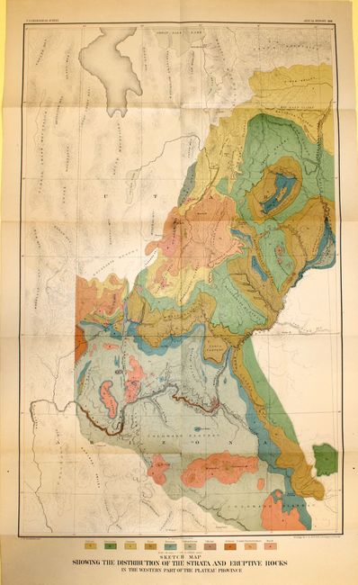
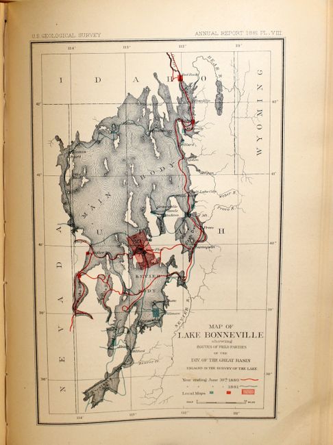
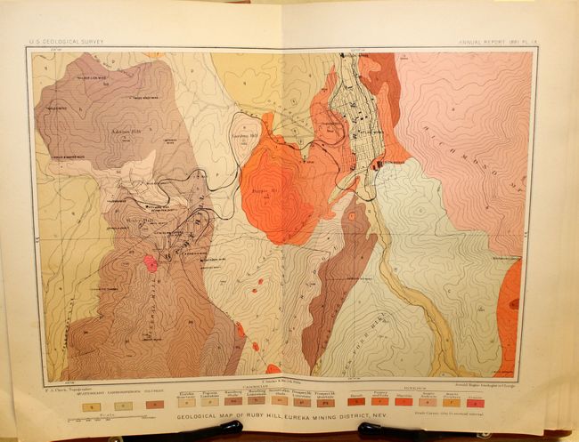
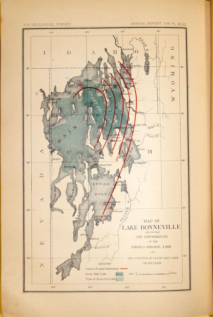
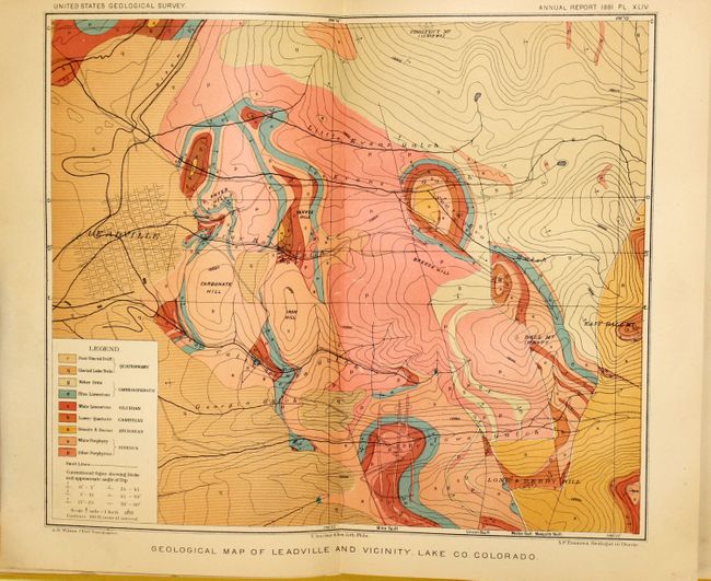
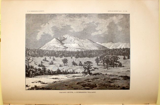
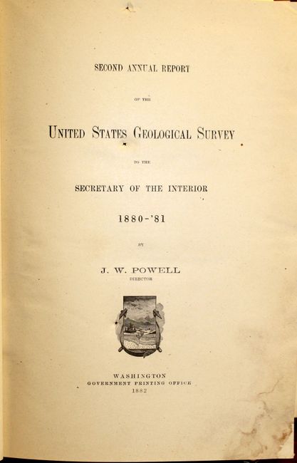
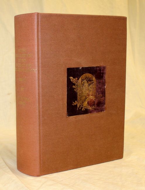
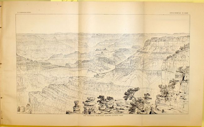
"Second Annual Report of the United States Geological Survey to the Secretary of the Interior 1880-'81", Powell, John Wesley

Subject: Geological Survey

Period: 1882 (published)

Publication:

Color: Printed Color

Size:
8 x 12 inches
20.3 x 30.5 cm
Download High Resolution Image
(or just click on image to launch the Zoom viewer)

A comprehensive report by the Director of the United States Geological Survey, describing all progress and discoveries made during 1880 and 1881. Includes 59 of 61 illustrative plates (missing only the small Virginia, Nevada map and the Washoe District plate) and a folding Sketch Map Showing the Distribution of the Strata and Eruptive Rocks in the Western part of the Plateau Province. This map is the first geological map of the Grand Canyon and the Colorado River upstream into central Utah.

In addition to the illustrations, the report provides the financial statement of the department, the administrative reports and accompanying papers. Included are the following reports: "The Physical Geology of the Grand Canon District" by Capt. Clarence Dutton; "Contributions to the History of Lake Bonneville" by G.K. Gilbert; "Abstract of Report on Geology and Mining Industry of Leadville, Lake County, Colorado" by S.F. Emmons; "A Summary of the Geology of the Comstock Lode and the Washoe District" by George F. Becker; "Production of the Precious Metals in the United States" by Clarence King; "A New Method of Measuring Heights by Means of the Barometer" by G.K. Gilbert.

The little known 119 pp. Grand Canyon report by Capt. Clarence Dutton predates but contains much of the same information and many of the same illustrations that are contained in the monograph that accompanies Dutton’s famous atlas Tertiary History of the Grand Canyon District. It includes a number of the extraordinarily detailed black and white panoramic drawings by William Henry Holmes of geological and terrain features in the Grand Canyon that were rendered in color in the later atlas. The large and significant folding color geologic map of the Grand Canyon that accompanies this report is identical to the geologic map in the Tertiary History monograph, but also covers large areas both south and north of the Grand Canyon that are not included in the map in the Tertiary History volume.

In addition, the report by G.K. Gilbert on Lake Bonneville is a preliminary version of his much better known 1890 report on Lake Bonneville, including a number of illustrations that are in his later monograph. Gilbert was one of the best known and highly respected geologists of the late 19th Century. Quarto, 588 pp., rebound in brown cloth with original gilt illustration pasted onto the new covers.

References:

Condition: B+

Pages, plates and map are mostly clean and bright with the first few pages having a minor damp stain in the lower right corner. The large folding map has a few tiny splits at fold intersections and a few minor spots. Covers and spine are very good, although cover label is stained.

Estimate: $400 - $500

Sold for: $300

Closed on 9/5/2012

Archived