Catalog Archive
Auction 141, Lot 663

"Carte de l'Isle de Sumatra Dressee sur les Journaux des Navigateurs et sur Plusieurs Cartes Manuscrites qui sont au Depot des Plans de la Marine", Bellin, Jacques Nicolas

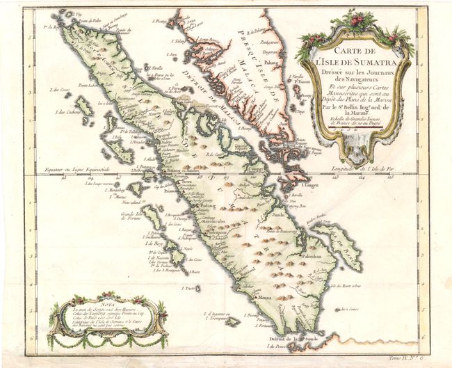
Subject: Sumatra, Indonesia

Period: 1754 (circa)

Publication: L'Histoire Generale des Voyages

Color: Hand Color

Size:
11.3 x 9.5 inches
28.7 x 24.1 cm
Download High Resolution Image
(or just click on image to launch the Zoom viewer)

This finely engraved copper-plate chart shows all of Sumatra and the southern portion of the Malaysian peninsula. Singapore is not identified, but several other lesser islands are named including Tioman Island, Banca, and Penang, plus many off the west coast of Sumatra. Good detail of the Straits of Malacca and the Detroit de Sincapour. The cities of Palembang, Jambi, Manimcabo, Aceh and Batang are located, but not Medan. Decorative French rococo-style cartouches contain the title and a second one at lower left for notes. At lower right below neatline is "Tome IX. No. 6."

References:

Condition: B+

Issued folding with a crowned dragon watermark, a long vertical printer's crease, and a few extraneous creases. A few small chips and tears in blank margins have been archivally repaired.

Estimate: $275 - $350

Sold for: $140

Closed on 9/5/2012

Archived