Catalog Archive
Auction 141, Lot 648

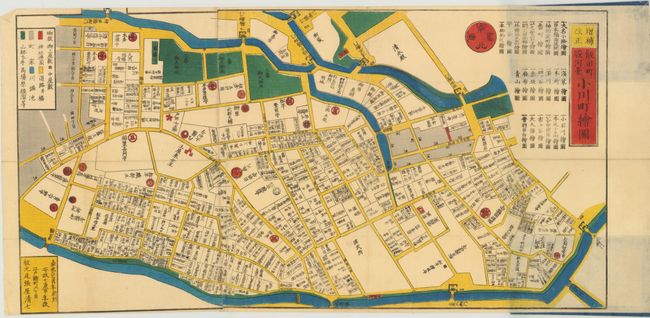
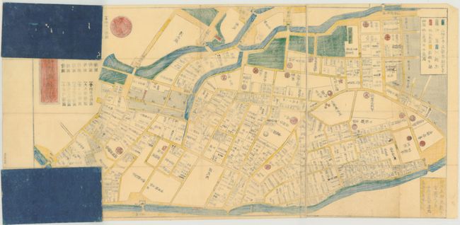
"[Japanese Pocket Map] Idamachi Surugadai Ogawamchi Ezu",

Subject: Tokyo, Japan

Period: 1860 (circa)

Publication:

Color: Hand Color

Size:
26.8 x 13.5 inches
68.1 x 34.3 cm
Download High Resolution Image
(or just click on image to launch the Zoom viewer)

This map was reportedly created by Kageyama Chikyo and published by Owariya Seishichi in "Ansei 7" or 1860. Although it is not listed among Edo maps published in Ansei 7, a map with the same title is listed as having been published in Ansei 6. We presume these to be the same map. The map shows the Surugadai and Ogawamachi areas, which lie within Chiyoda City, one of the 23 special wards in Tokyo. This colorful woodblock pocket map folds into hard paper self wrappers in bright blue. The paper label typically found on the front is missing. Travel and tourist maps are called dochuzu or "on-the-road-maps".

References:

Condition: A

Remarkable condition given its age, intended use, and fragility of construction. The paper covers do not have paper labels as traditionally found. There are a few minute splits at fold intersections as often seen with these maps. The covers are in good condition with one short worm track and a couple of small areas of rubbing affecting blue color.

Estimate: $400 - $500

Sold for: $325

Closed on 9/5/2012

Archived