Catalog Archive
Auction 141, Lot 56

"Septentrionalium Terrarum Descriptio", Mercator/Cloppenburgh
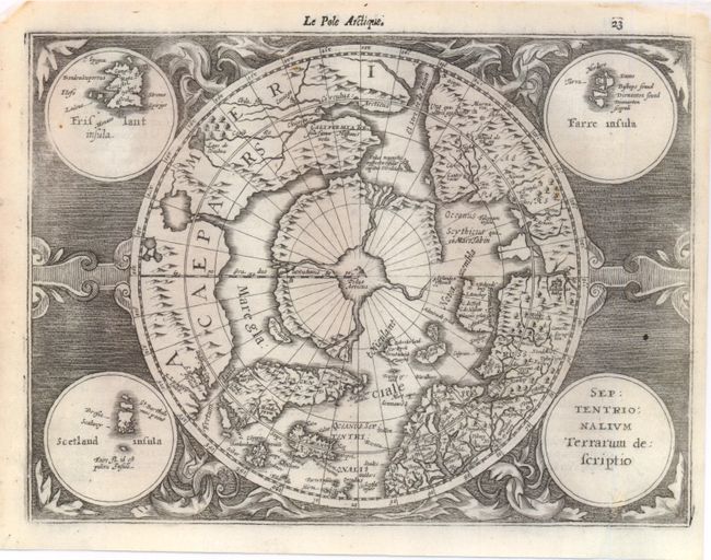
Subject: North Pole

Period: 1630 (circa)

Publication: Atlas Minor

Color: Black & White

Size:
9.8 x 7.5 inches
24.9 x 19.1 cm
Download High Resolution Image
(or just click on image to launch the Zoom viewer)

First state of this reduced version of Mercator's famous map of the North Pole. The hemisphere is surrounded by a finely engraved design with four round insets in each corner. These contain the title, the Faeroe Isles, the Shetland Isles, and the mythical island of Frisland. The North Pole is shown according to legend as a large rock in a giant whirlpool surrounded by four islands separated by rivers. The magnetic pole is depicted as an island in the Strait of Anian. An elaborate river network and large bay is shown in the extreme northwest part of North America. Le Pole Arctique and page number 23 at top right above map with French text on verso.

References: Burden #225; Kershaw #32.

Condition: B

There are two tiny worm holes in image at left and a small hole at bottom right that has been professionally repaired, with a small amount of image in facsimile. A tear in the upper-right corner has also been repaired. Backed in Japanese tissue.

Estimate: $500 - $650

Sold for: $375

Closed on 9/5/2012

Archived