Catalog Archive
Auction 141, Lot 155

"Estados Unidos de la America Septenl. Parte de la Floriday el Canada", Lopez de Vargas Machuca, Thomas (don)

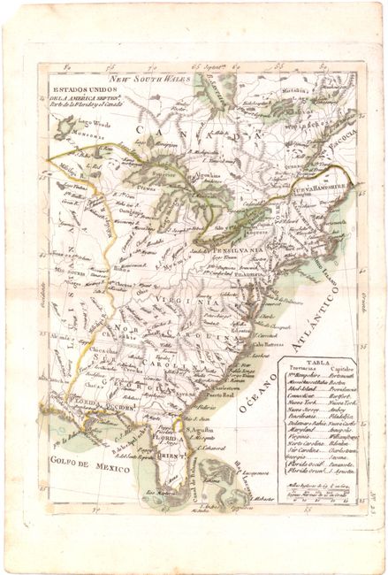
Subject: Eastern United States

Period: 1792 (circa)

Publication: Atlas Elemental

Color: Hand Color

Size:
7.1 x 9.6 inches
18 x 24.4 cm
Download High Resolution Image
(or just click on image to launch the Zoom viewer)

A very uncommon Spanish map depicting the eastern coast of North America from Nova Scotia to Florida. The map is based upon Rigobert Bonne's map of 1783 issued in Petit Atlas Moderne. Cartographically, Virginia, North Carolina, South Carolina and Georgia extend west to the Mississippi River, while Pennsylvania extends to 43 degrees, just south of Lake Ontario. West Florida and East Florida are noted. A table at lower right lists the capitols of the states.

References: cf McCorkle #783.8; cf. Sellers & van Ee #183.

Condition: B+

Watermarked paper with a few minor spots in the image.

Estimate: $275 - $350

Unsold

Closed on 9/5/2012

Archived