Catalog Archive
Auction 140, Lot 98

"Statistical Map of North America to Illustrate M. De Tocqueville's Democracy in America",

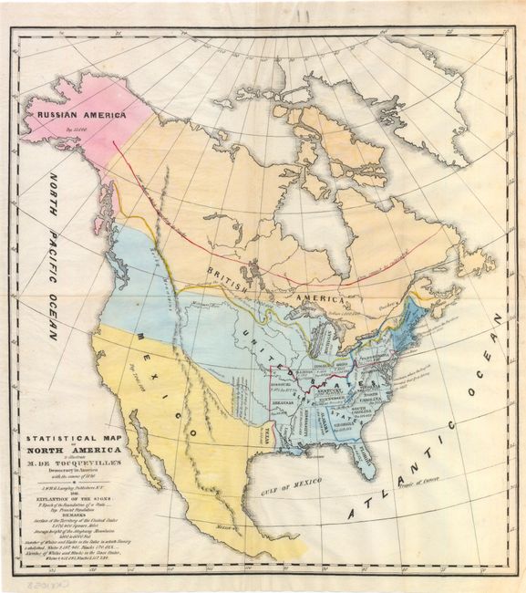
Subject: North America

Period: 1841 (dated)

Publication: Democracy in America

Color: Hand Color

Size:
13.3 x 14.5 inches
33.8 x 36.8 cm
Download High Resolution Image
(or just click on image to launch the Zoom viewer)

Very uncommon map from the American edition of De Tocqueville's "Democracy in America" published by J. & H.G. Langley. The map gives the population for the United States per the census of 1840, as well as British America, Russian America and Mexico. The United States claims into British America in the northwest are prominently delineated. While not delineated from Mexico, a presumably independent Texas is shown with a population of 200,000. Underneath the title, White and Black populations for the non-slave holding states and slave holding states are noted. A line in what is now central Canada notes the northern extent of corn cultivation and another line denotes "the separation of the rivers and divides the continent into two vast regions." There are a few other notes including one west of Arkansas that notes the "Limits of the Great Desert inhabited only by Buffalos, Wild Horses, and a few Wandering Tribes of Indians." Issued on thin banknote-style paper.

References:

Condition: B+

Original color on watermarked paper with one tiny edge tear at right that just passes the neatline which has been archivally repaired, and a few small extraneous creases. Issued folding.

Estimate: $250 - $325

Sold for: $200

Closed on 5/23/2012

Archived