Catalog Archive
Auction 140, Lot 914

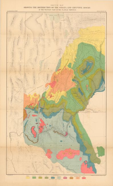
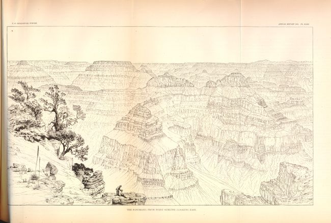
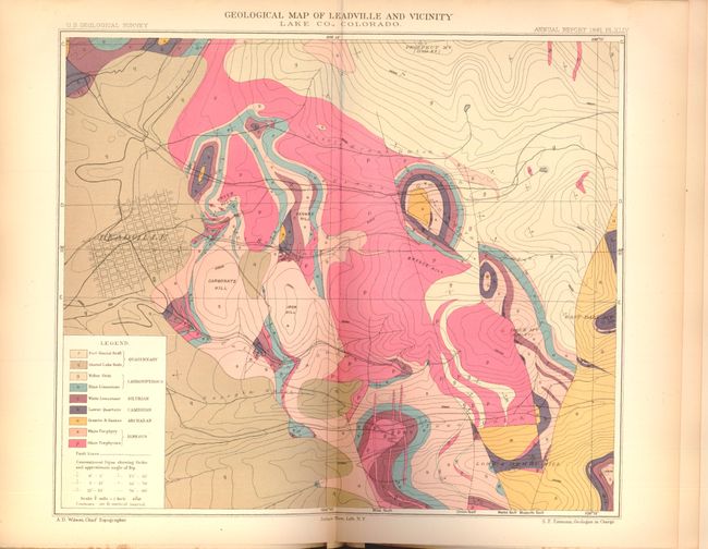
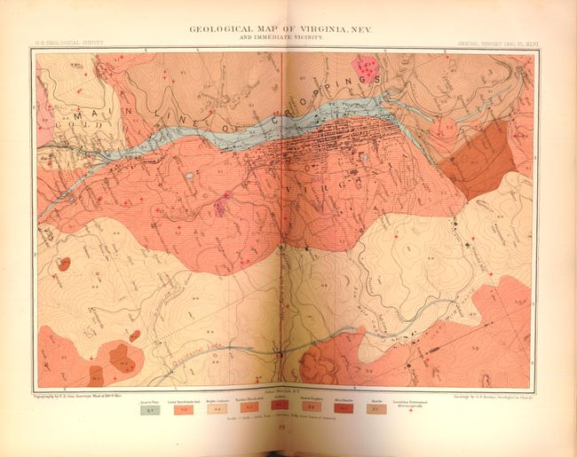
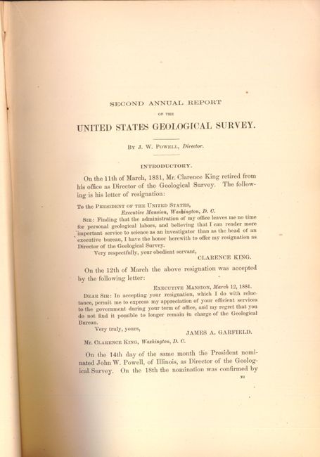
"[Second Annual Report of the United States Geological Survey by J.W. Powell] Report of the Secretary of the Interior; being part of the Message and Documents communicated to the Two Houses of Congress…", Powell, John Wesley

Subject: Exploration and Surveys, Grand Canyon

Period: 1882 (dated)

Publication: Department of the Interior

Color: Printed Color

Size:
8 x 11.5 inches
20.3 x 29.2 cm
Download High Resolution Image
(or just click on image to launch the Zoom viewer)

This important and almost complete volume (missing only Plate IX - Geologic Map of Ruby Hill - Eureka Mining District) contains reports on the Grand Canyon by Dutton; plus others including the history of Lake Bonneville; the geology of the Leadville, Comstock, and Eureka districts; the copper-bearing rocks of Lake Superior; and more. Also includes the administrative annual reports of F.V. Hayden, Clarence King, Dutton and others. Filled with colorful geological plates, plus the wide, folding b&w plates of the Grand Canyon such as: "Plateau Scenery - the Mesa Verde"; "Looking up the Toroweap Valley. Lava Cascades"; "The Panorama from Point Sublime - Looking East (also south and west)"; the "Vermillion Cliffs at Kanab"; "Kanab Canon" and more. Many of the wood engraved full page images are by Thomas Moran. Includes the colorful geological folding map at back in the original pocket entitled Sketch Map Showing the Distribution of the Strata and Eruptive Rocks in the Western Part of the Plateau Province (17.5 x 28.5").

This map is a very detailed and strongly colored geological map from the U.S. Geological Surveys. It details the region from Prescott (Ft. Whipple) and Camp Verde north through the Grand Canyon and Marble Canyon, today's Canyonlands National Park, Moab, and the southern portion of the Great Salt Lake. The map locates the Wasatch and Uintah Mountains, the Bad Land Cliffs (Book Cliffs), the San Juan River, etc. and has remarkable detail of the watershed and topography. This thematic map identifies ten geological units through color including: Tertiary, Cretaceous, Jurassic, Trias, Permian, Carboniferous, Silurian, Archaean, Trachyte Rhyolite & Andesite, and Basalt. Engraved by J.H. Renshawe.

Quarto, 588 pages, bound in black cloth with gilt lettering on spine. Includes 62 plates and maps, with many fold-outs and some in color, and 32 figures.

References:

Condition: A

Maps, plates and text are very good to fine with some very minor occasional foxing and a few tiny damp stains. Covers show some light wear and staining and the edges are slightly bumped, and the hinges are starting.

Estimate: $350 - $425

Sold for: $300

Closed on 5/23/2012

Archived