Catalog Archive
Auction 140, Lot 911

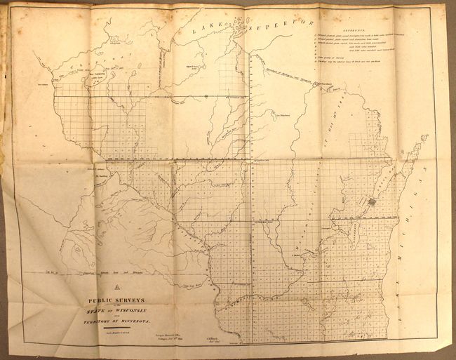
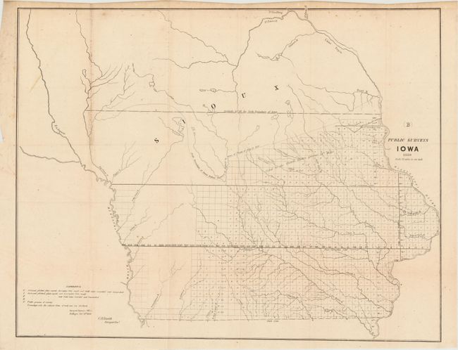
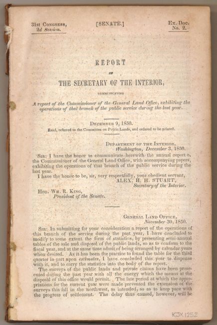
"A Report of the Commissioner of the General Land Office", U.S. Government

Subject: Exploration and Surveys

Period: 1850 (dated)

Publication: Senate Ex Doc. 2, 31st Cong., 2nd Sess.

Color: Hand Color

Size:
6 x 9 inches
15.2 x 22.9 cm
Download High Resolution Image
(or just click on image to launch the Zoom viewer)

This early annual report contains eleven maps detailing the progress of public surveys in the United States. The maps included with the 157 pp. report are:

A. Public Surveys in the State of Wisconsin and Territory of Minnesota, black & white, (22.5 x 17.8")
B. Public Survey Iowa , black & white, (22.5 x 17.5")
C. Arkansas, hand color, (21 x 16")
D. Sketch of the Public Surveys in Michigan, black & white, (21 x 24.5")
E. Map of Louisiana Representing the Several Land Districts, hand color, (16 x 15.3")
F. [Lot of 4 - Surveys of Florida], black & white
G. Diagram of the State of Missouri, black & white, (21.5 x 17.5")
H. Diagram of the State of Illinois, black & white, (12.5 x 21.5")

These maps are bound into the original report by Alex H. H. Stuart, Secretary of the Interior to the Hon. Wm. R. King, President of the Senate. 8vo, disbound.

References:

Condition: B

The maps are good with some minor extraneous creasing and occasional light foxing. The map of Iowa is disbound. Issued folding.

Estimate: $120 - $150

Sold for: $70

Closed on 5/23/2012

Archived