Catalog Archive
Auction 140, Lot 813

"Barbariae et Guineae Maritimi a Freto Gibraltar ad Fluvium Gambiae cum Insulis Salfis Flandricis et Canaricis", Renard/De Wit

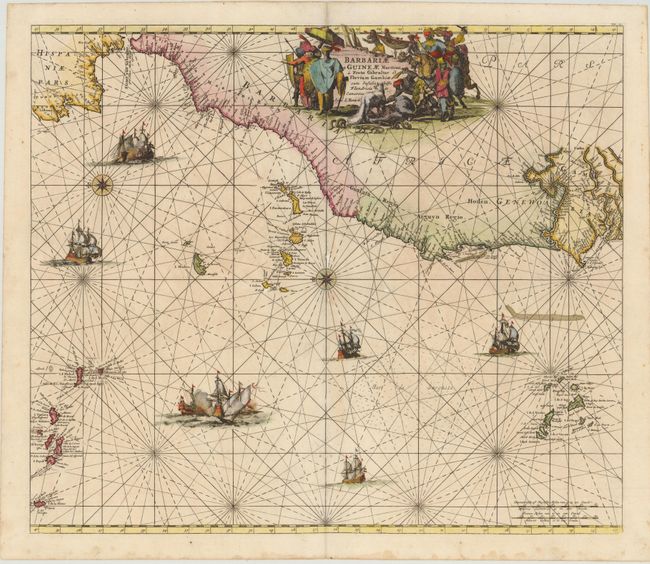
Subject: Northwest Africa

Period: 1715 (circa)

Publication:

Color: Hand Color

Size:
22 x 19 inches
55.9 x 48.3 cm
Download High Resolution Image
(or just click on image to launch the Zoom viewer)

This decorative sea chart of the Barbary and Guinea coasts extends to include part of the coastline of Portugal and Spain. Two compass roses orient north to the left, and there is good detail of the Azores, Madeira, Canary, and Cape Verde Islands. Additional detail is confined to the coasts with numerous place names. The interior of Africa is filled with a decorative title cartouche depicting fat-tailed sheep, a lizard, and snakes in the foreground, with African pirates, merchants and slave-traders. The man at front right holds a scimitar in one hand and a decapitated head in the other hand. The map is further embellished by several sailing vessels, while others are engaged in battle. This is the Renard edition of the map that was first published by Frederick de Wit, circa 1675.

References: cf. Norwich #252.

Condition: B+

There is some minor toning and small worm holes and tracks (primarily along centerfold) that have been professionally infilled, with a small amount of image in facsimile.

Estimate: $700 - $900

Sold for: $500

Closed on 5/23/2012

Archived